Cyclone Ditwah Ravages Sri Lanka: Heads For Tamil Nadu
Key Takeaways
- Cyclone Ditwah caused exceptionally heavy rainfall over Sri Lanka, triggering floods, landslides, and major loss of life.
- The system is weakening due to rising wind shear but will continue tracking north-northwest toward the Palk Strait and Southwest Bay of Bengal.
- Heavy to very heavy rainfall is expected over South Tamil Nadu and Kerala initially, later shifting toward Chennai and North Coastal Tamil Nadu.
- The system may weaken to a depression and then a low-pressure area while moving toward South Coastal Andhra Pradesh.
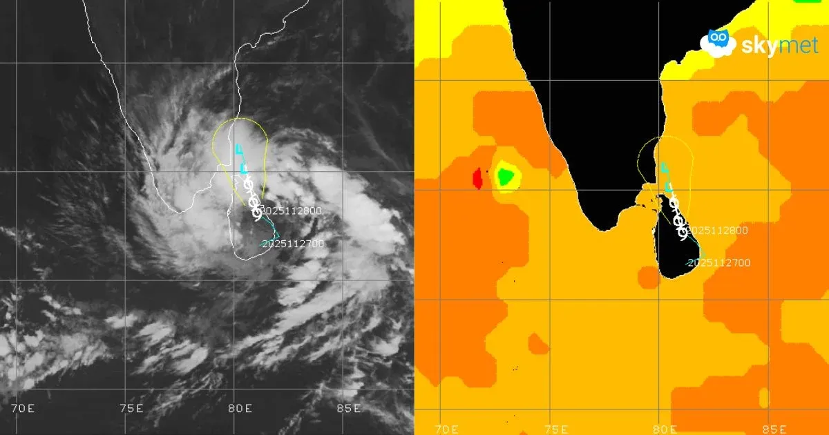
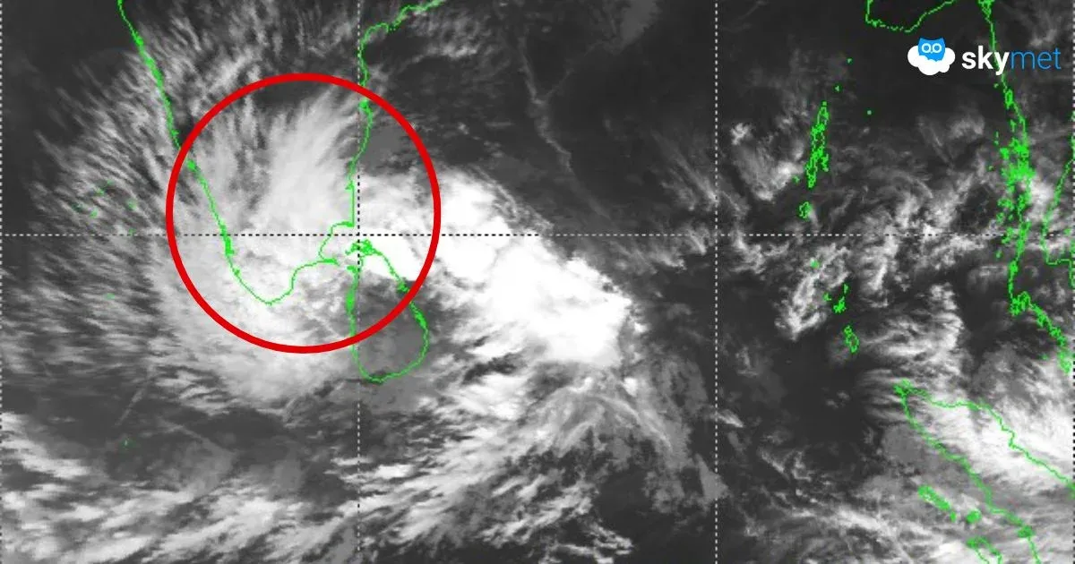
The cyclonic storm ‘Ditwah’ crossed the southern coast of Sri Lanka and dumped very heavy to exceptionally heavy rainfall over the island nation in the past 24 hours. The port city of Trincomalee received 261.5 mm, and the green forest region of Vavuniya recorded 358.5 mm of rainfall. Extremely heavy rains have triggered floods and landslides. An estimated 40 people have been killed, and several are missing. Over 400 houses have been damaged, about 1,800 families shifted to safe shelters, and Parliament sittings have been postponed in the wake of severe weather conditions.
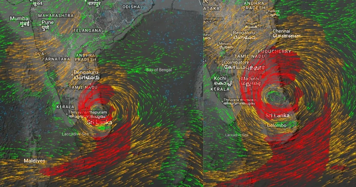
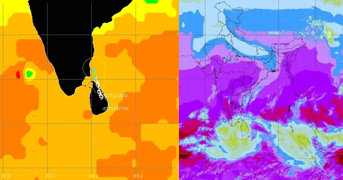
The storm is now centered around 8.1°N and 81.1°E, about 90 km northwest of Batticaloa and 540 km south of Chennai. The storm moved northward to cross the coast and made landfall yesterday. It is a slow-moving system and has drifted with a speed of about 7 km/h in the last 12 hours. Ditwah will continue moving nearly north-northwest and is expected to vacate Sri Lanka by early tomorrow. The environmental conditions have a mixed response. Land friction will reduce as the storm heads for the Palk Strait and Southwest Bay of Bengal. The warm sea surface temperature is supportive of sustaining intensity. However, the southerly wind shear is increasing significantly, which will offset the positive parameters and erode the main configuration of the storm. The well-defined low-level circulation over land is likely to get obscured and weaken gradually.
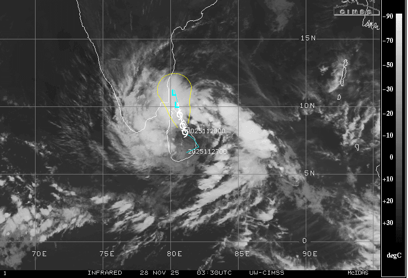
After the storm clears the Jaffna Peninsula and moves abeam the Palk Strait to enter the Southwest Bay of Bengal, it is likely to weaken over ocean waters within the next 36–48 hours.
The weakened system will continue moving northward, remaining in close proximity to the south coastal districts of Tamil Nadu. Sometime late on 30 November or during the early hours of 01 December, the diluted system will pass abeam the capital city Chennai and drift further away toward South Coastal Andhra Pradesh. Heavy to very heavy rains are likely over South Tamil Nadu and interiors of Kerala on 28 and 29 November. The intense rainfall belt will shift northward to cover North Coastal Tamil Nadu, including Chennai, and interior parts of the state between 29 November and 01 December. Heavy rains will reach Puducherry, Karaikal, South Coastal Andhra Pradesh, Rayalaseema, and South Interior Karnataka during this period.
The weather system will weaken to a depression after moving abeam Chennai and may further lose strength to become a low-pressure area off the Andhra Pradesh coast. Tamil Nadu and Andhra Pradesh need to prepare for inclement weather conditions between 29 November and 02 December 2025.


