


Image: AI-Skymet
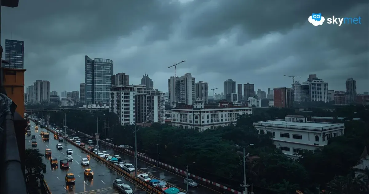
Mumbai witnessed moderate to heavy rains starting Sunday night and continuing nearly non-stop till Monday evening. As usual, there was waterlogging, traffic snarls, and commuters’ plight to begin the week. The worst of the current spell looks to be over and what is left now seems manageable. ‘Off and on’ rains with adequate breaks in between will remain the hallmark for the remainder of the week. One or two heavy showers in some parts, albeit for short duration, will remain in place to keep the continuity of monsoon. Withdrawal of monsoon is a far-fetched scenario and may easily stretch till the fag end of the month. The normal date, of course, extends to the first week of October.
The city has witnessed a decent monsoon season. The first half was uneventful and both June and July managed near-normal rainfall. The deluge came in August, wherein the city amassed double the normal rainfall. Santacruz, the airport observatory, recorded 1164.5 mm rainfall against the normal of 585.2 mm. The city was literally drowned in the third week of the month and registered a massive 875 mm rainfall, much more than the monthly normal, in just 5 days between 16th and 20th August 2025. September has also kept pace and recorded 323.3 mm rainfall against the normal of 341.4 mm. The city is likely to exceed this figure, albeit by a small margin, in the remaining days of the month.
The main trigger for the current rainy spell was the remnant circulation of a low-pressure area over Vidarbha, Marathwada, and adjoining parts. Moderate to heavy rains still continue over landlocked regions of Maharashtra. The rains have eased along the coast, including Mumbai. The persisting circulation is likely to soften and drift away from the Konkan region. Finally, it may get subsumed by another circulation coming up over Uttar Pradesh and North Madhya Pradesh. Accordingly, Mumbai will go on with normal monsoon activity, without any escalation to perceptible threat for the common man.
There is another monsoon system likely to evolve over the Bay of Bengal shortly. A cyclonic circulation may appear on 20th Sep over the West-Central Bay of Bengal. Under its influence, a low-pressure area is likely to form on 21st Sep off the Andhra-Odisha coast. The system will move inland the next day. However, unlike its predecessor, it will not go very far and will keep meandering over the Odisha-Chhattisgarh region. The convergence zone in the forward section of the system will reach the Mumbai coastline. An uptick in weather activity is expected over Mumbai and suburbs between 23rd and 24th Sep 2025. Weather conditions will improve thereafter and stay good till the end of the week.


