Daily Weather Update for India, February 18: Forecast and Regional Conditions

Key Takeaways:
- A low-pressure system over the equatorial ocean is expected to strengthen near the southwest Bay of Bengal.
- Western Disturbance is expected to bring rain, thunderstorms, and snowfall across parts of North India.
- Andaman & Nicobar Islands are likely to see rain with strong winds on Feb 17–18.
- Minimum temperatures are rising slightly over northwest India in the next two days.
Weather systems over the country
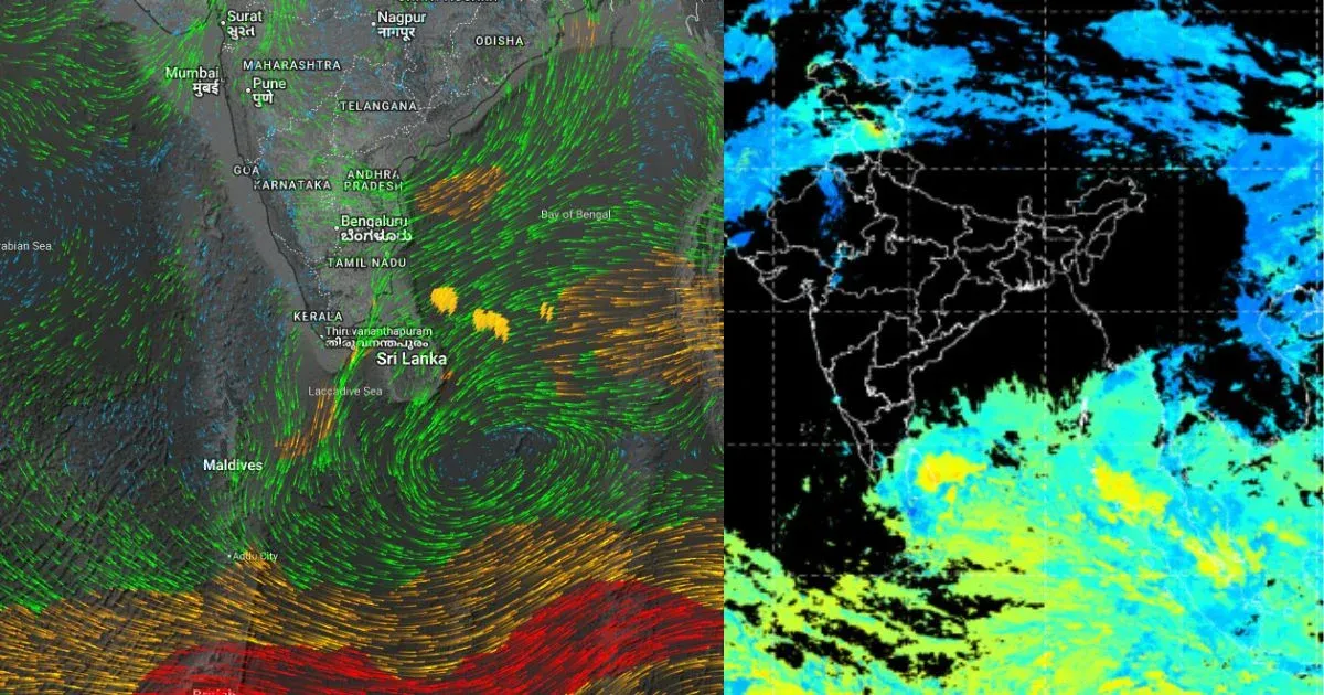
A low-pressure area is over the equatorial Indian Ocean and adjoining central parts of the South Bay of Bengal. The associated cyclonic circulation extends up to 5.8 km above mean sea level. It is expected to move in a west-northwest direction and become more marked over the southwest Bay of Bengal and adjoining east equatorial Ocean around February 18.
A Western Disturbance is seen as a cyclonic circulation and now lies over central Pakistan and adjoining areas at 3.1 km above mean sea level. A trough is also seen in the middle and upper tropospheric westerly winds, with its axis at 5.8 km above mean sea level, roughly along longitude 67°E to the north of latitude 25°N.
An induced upper-air cyclonic circulation is over Punjab and adjoining areas and extends up to 1.5 km above mean sea level.
Weather activity during the last 24 hours
During the last 24 hours, weather remained dry over the country.
Minimum temperatures increased by 3°C to 4°C over parts of northwest India.
Weather Forecast:
During the next 24 hours, isolated rain and snowfall may occur over Himachal Pradesh and Uttarakhand on February 18 and 19.
Isolated light rain, thunderstorms, and lightning may occur over Punjab, Chandigarh, Haryana, Delhi, and Rajasthan on February 17 and 18.
Isolated light rain, thunderstorms, and lightning may occur over Madhya Pradesh on February 18.
Andaman and Nicobar Islands may receive rain and thunderstorms with strong winds on February 17 and 18.
Minimum temperatures may increase marginally over northwest India during the next two days.