Cyclonic Storm 'Senyar' Forms Over Andaman-Nicobar: Likely To Weaken

Key Takeaways
- Cyclonic Storm Senyar formed near the Strait of Malacca but is trapped in a weak, meandering zone.
- Strong easterly wind shear and land friction are disrupting the system’s structure.
- Its low latitude is preventing the Coriolis force required for intensification.
- The storm will weaken near Indonesia with no threat to India’s East Coast.
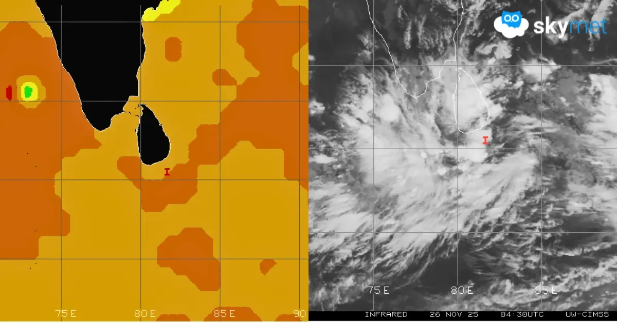
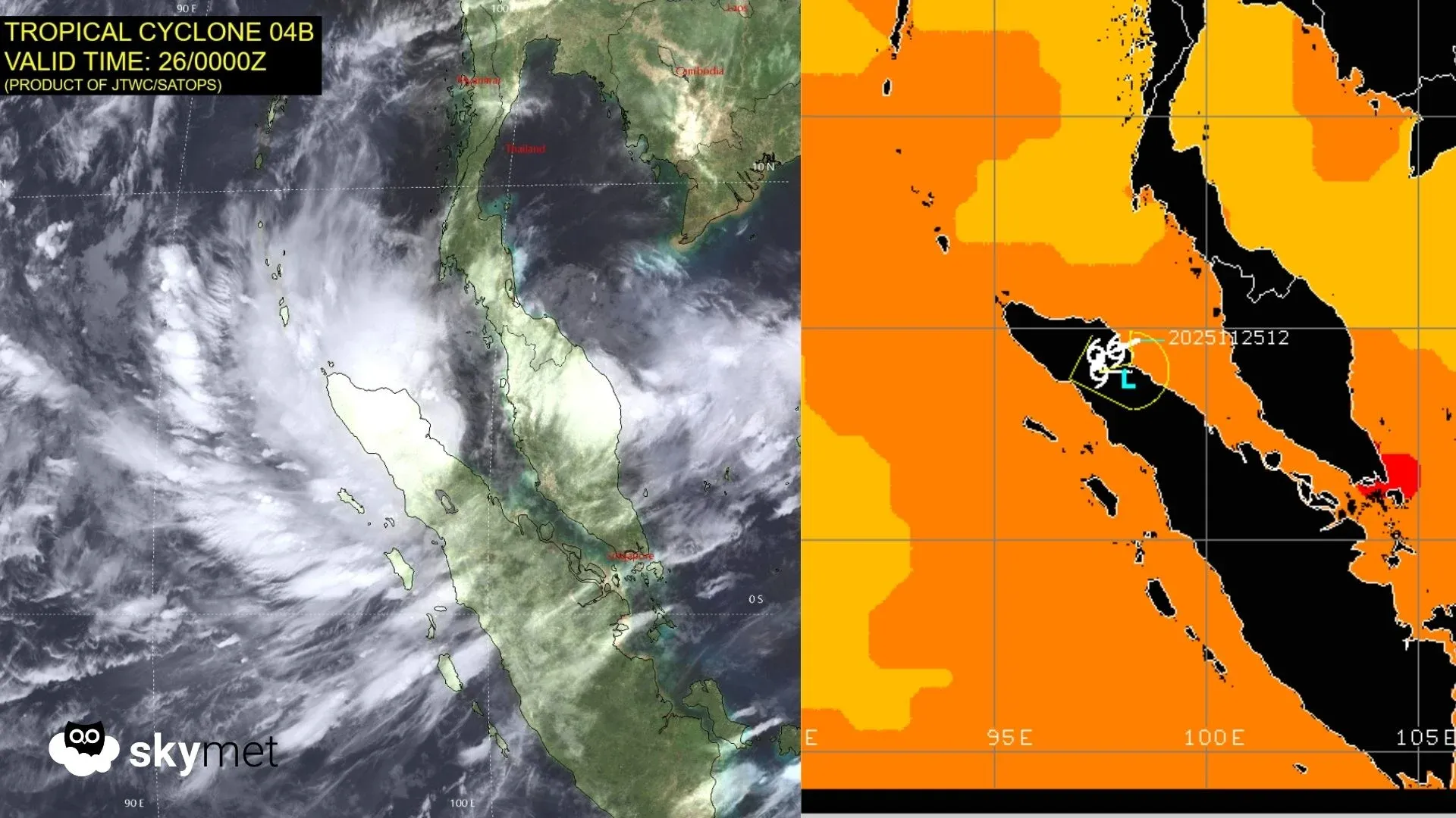
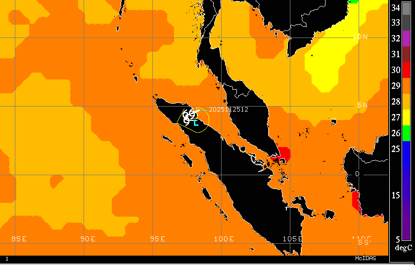
Under the influence of a deep depression over the extreme southern parts of the Andaman–Nicobar region, a cyclonic storm has formed over the area. The storm is positioned over the Strait of Malacca and the adjoining Indonesian region and neighbouring Andaman Sea. It is currently centered near 4.5°N and 98°E, about 600 km east-southeast of Nancowry Island over the South Andaman Sea. The cyclonic storm has been named Senyar by the member country United Arab Emirates. The storm is expected to meander over the same region, within +/- 1° of latitude and longitude, with minimal chances of intensification.

The storm was anticipated to form over this region, but not with such rapid signs of weakening. Although sea surface temperatures remain favourable for its sustenance and potential growth, several atmospheric parameters are contributing to its decline. The system is experiencing significant easterly wind shear. Environmental conditions are deteriorating, and frictional influences due to its proximity to land are becoming dominant. The low-level cyclonic circulation is weakening, and its structural features are becoming increasingly obscured. Another major limiting factor is its location at low latitudes near the equatorial region. This position results in insufficient Coriolis force, which is essential for cyclonic intensification. Any further loss of latitude will accelerate the storm’s weakening.
The storm is likely to drift in a zig-zag manner over the extreme northern parts of Indonesia, near the Strait of Malacca, before eventually dissipating in the same region. It will produce heavy to very heavy rainfall over the area for the next 24 hours. Senyar may go down as one of the shortest-lived storms over the North Indian Ocean. Its remnants may persist for another 24–36 hours and should be monitored for any unexpected developments, although significant re-strengthening remains unlikely. Any earlier speculation about a potential threat to the East Coast from this system can now be ruled out.