Another Storm Likely Over Bay Of Bengal: Heavy Rains Over Tamil Nadu-Andhra

Key Takeaways
- A new storm is likely to develop over the Southwest Bay of Bengal.
- Tamil Nadu and Andhra Pradesh may see heavy to very heavy rain on Nov 29–30.
- A merging Arabian Sea circulation could boost the system’s intensification.
- Low latitude limits rapid strengthening, but other conditions remain favourable.
While the threat to the East Coast from the evolving storm over the Andaman Sea has faded, yet another storm is likely to develop over the Southwest Bay of Bengal (BoB). This system may lash the coastlines of Tamil Nadu and Andhra Pradesh with heavy to very heavy rainfall. It is an unusual position for a storm to develop, but cyclones often defy established logic and norms. The likely cyclone is expected to ravage Sri Lanka, the Gulf of Mannar and the Comorin area first, before moving on to impact Tamil Nadu, the Palk Strait and Andhra Pradesh.

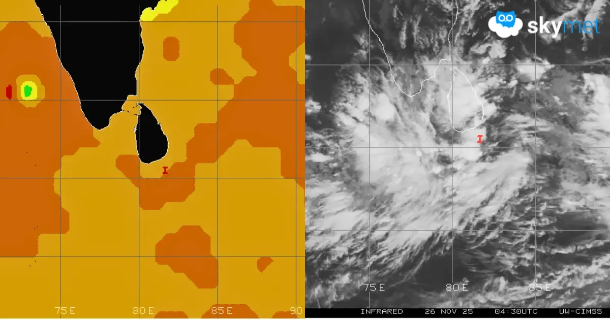
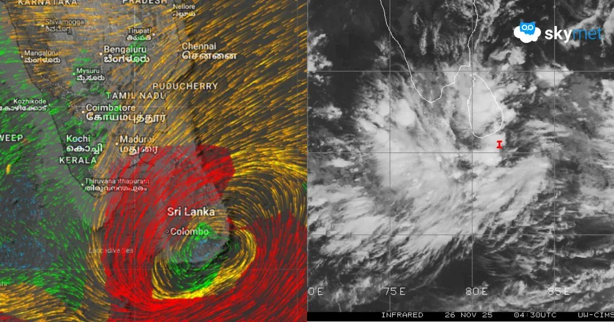
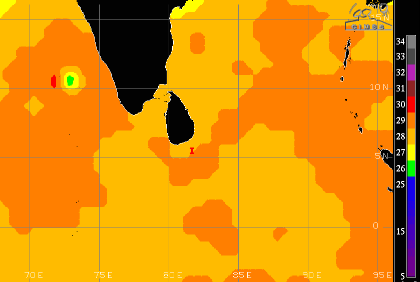
A well-marked low-pressure area persists over the Southwest BoB, Southeast Sri Lanka and the adjoining equatorial region. The core is centered near 5.7°N and 81.7°E in the open sea, south of the Sri Lanka mainland. Once again, this system is positioned in lower equatorial latitudes, where the Coriolis force is weak and insufficient for strong intensification. However, other environmental conditions remain favourable. Sea surface temperatures are well above the threshold, wind shear is moderate and the cloud configuration indicates developing formative bands that are expected to become sharper and more organized.
The low-pressure system is likely to intensify into a depression within 24 hours and further strengthen into a deep depression over the same region. Another positive sign is the presence of a well-marked cyclonic circulation over the extreme southeastern Arabian Sea, near the equatorial Indian Ocean. As the system moves towards storm stage around 28–29 November 2025, this circulation is anticipated to shift northward and eventually merge with it, providing a significant boost. This consolidation is expected before the storm heads toward the Gulf of Mannar and the southeast coast of Tamil Nadu.
Rainfall is likely to begin over south coastal Tamil Nadu on 28 November, with the peak intensity expected on 29 and 30 November 2025. Model reliability decreases beyond a four-day lead time, and more precise projections will emerge once the system organizes into a depression or deep depression. In the meantime, the states of Tamil Nadu and Andhra Pradesh should prepare resources and readiness measures to meet the potential challenge.