

Low Pressure Area Over Bay Of Bengal: Active Monsoon Over East And Northeast India

Key Takeaways:
- A low-pressure area has formed over the North Bay of Bengal, marking the season's second monsoon system over the Indian Seas.
- Moderate to heavy rainfall is expected across Odisha, West Bengal, Bihar, Jharkhand and Northeast India through July 22.
- The weather system is expected to remain nearly stationary, an unusual characteristic for a monsoon low-pressure system.
- While East and Northeast India will witness an active monsoon phase, much of the rest of India is likely to continue with below-normal monsoon activity.
- Forecast Validity: Next 5 to 7 days.
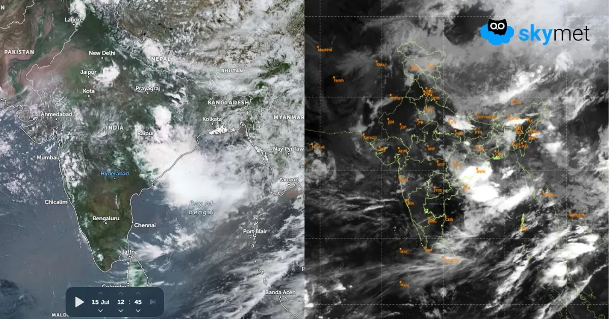
Under the influence of a cyclonic circulation over the North Bay of Bengal, a low-pressure area has formed over the same region. This is the second monsoon system over the Indian Seas during the current southwest monsoon season.
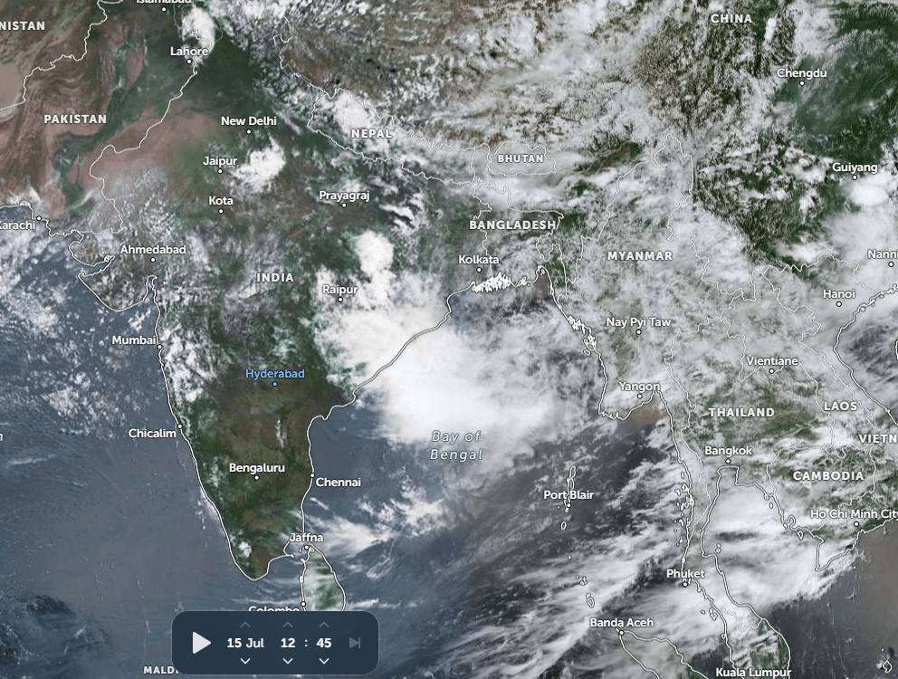
The system is likely to move west-northwest and meander over the same region, partly over the sea but largely over land, during the next four to five days. Its circulation extends up to the mid-tropospheric levels and covers parts of Bangladesh, Gangetic West Bengal and Coastal Odisha. At present, there is no indication of the system moving deep inland, and it is expected to remain confined to the eastern states of West Bengal, Odisha and Bihar.
East and Northeast India continue to have a significant seasonal rainfall deficit. The presence of this system over the region during the next few days is expected to bring widespread monsoon showers and help reduce the rainfall shortfall. Initially, the entire Northeast is likely to receive fairly widespread rain and thundershowers, with heavy rainfall at a few places, for the next week or even longer.
Coastal and interior parts of Odisha, along with Gangetic West Bengal, are expected to receive moderate to heavy rainfall between July 15 and 17. The heavy rainfall belt is likely to shift towards North Bengal and Northeast Bihar on July 18 and further extend into East Uttar Pradesh, North Chhattisgarh, most parts of Bihar and Jharkhand between July 19 and 22, 2026.
The cyclonic circulation is expected to remain mostly over land between July 18 and 21. Thereafter, from around July 22 onwards, the weather system appears likely to reorganize while remaining over nearly the same region. This behaviour is unusual for a typical monsoon low-pressure system, which generally moves steadily inland. The prolonged persistence of the system over the same area presents a rather uncommon monsoon scenario.
While this system is expected to significantly revive monsoon activity across East and Northeast India, the rest of the country is likely to remain under the influence of a weak monsoon regime. Consequently, the rainfall deficit over central, western and northwestern parts of India may not improve and could even widen further during the second half of July.
A sharp contrast in monsoon activity is expected across the country, broadly separated by 85°E longitude—active to vigorous monsoon conditions over East and Northeast India, while much of the remaining region continues to witness subdued monsoon activity.
Trending:



