


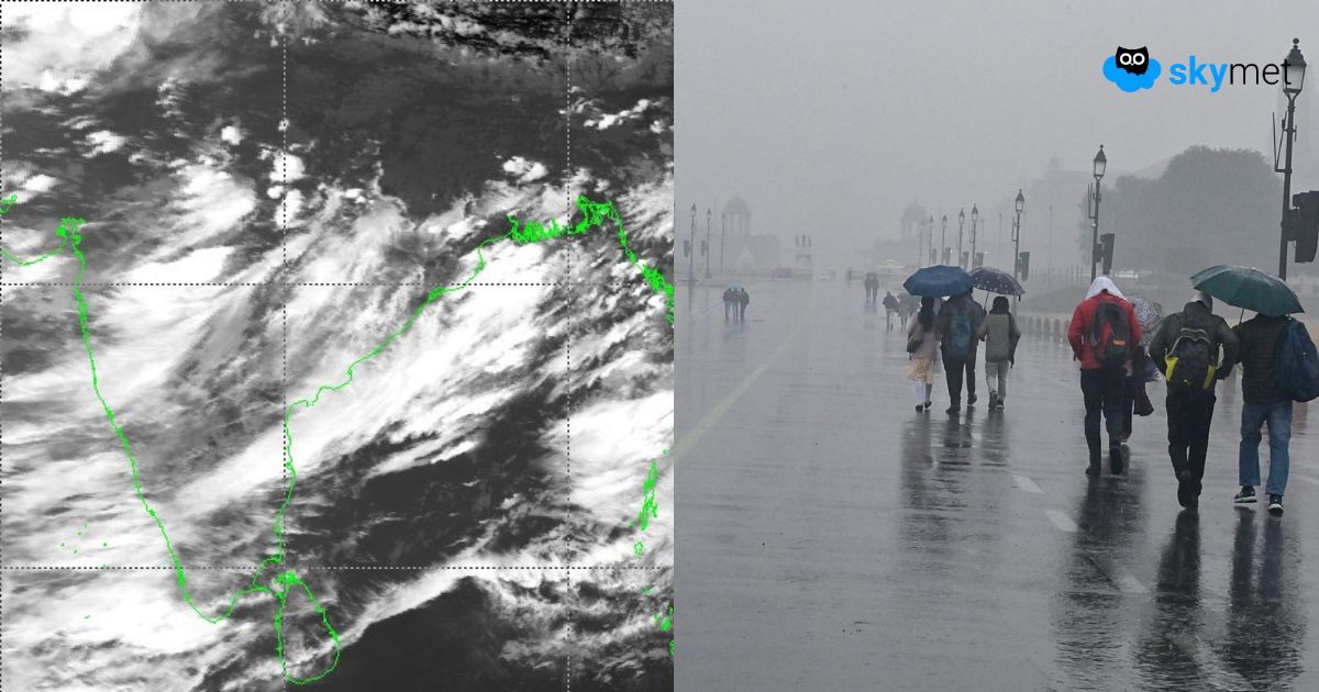
The low-pressure area persists over the northwest Bay of Bengal and adjoining West Bengal and Bangladesh. It is well supported by cyclonic circulation up to the higher levels. The low-pressure area will move slowly west-northwest across North Odisha, West Bengal, Jharkhand, and North Chhattisgarh over the next two days. Under its influence, the monsoon trough extending from Ganganagar in Rajasthan to Kolkata will remain active, resulting in fairly widespread rainfall all along.
The rainfall belt will gradually shift from east to west—from Odisha-West Bengal to Rajasthan-Gujarat—in a staggered manner with overlapping zones over the next four days. Today, scattered rain and thundershowers are likely over Gangetic West Bengal, North Odisha, and Jharkhand. Tomorrow, the low-pressure system is expected to move over land, and the weather activity will extend further to cover Chhattisgarh and Jharkhand. The peripherals of the system will reach the outskirts of East Madhya Pradesh. Later, the next day, the weather system will be completely over the hinterland of Madhya Pradesh and Chhattisgarh. The intense weather activity will cover Madhya Pradesh and Chhattisgarh. The convergence zone of the system will stay far ahead of the center and trigger rain and thundershowers over West and Southwest Madhya Pradesh, Southeast Rajasthan, and North Madhya Maharashtra. Weather activity will breach parts of North Gujarat as well.
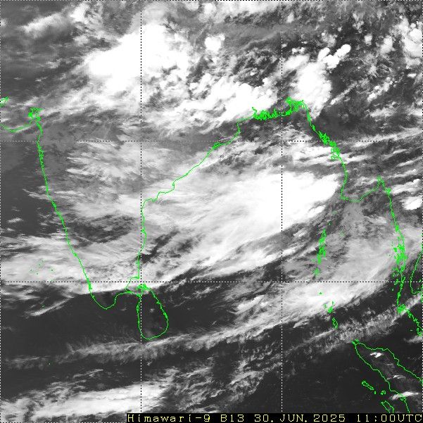
In the meantime, another cyclonic circulation will appear over Gangetic West Bengal and the Bangladesh region on 3rd July. The feature will shift inland the next day. Both these circulations will join hands to form an axis of the east-west shear zone running across 25°N, from one end of Gujarat to the other shore of Odisha. Active monsoon conditions will prevail, with likely heavy rainfall over Madhya Pradesh, Rajasthan, Gujarat, and Madhya Maharashtra. The Bundelkhand region of Uttar Pradesh will also receive a fair amount of intense rain and thundershowers, while other parts will observe light to moderate rainfall activity.
Southern parts of the country, including Kerala, will have lean weather activity during this period. While the central and western parts of the country may receive above-normal rainfall in the next one week, most of the southern sub-divisions will observe a major shortfall. Though it is too early to say, the indications are that the eastern end of the monsoon trough may shift north of its normal position along the foothills after 8th July. This may result in increased rainfall activity over Northeast India around those days.


