

Monsoon Depression Tracks Westward: Very Heavy Rainfall Over Maharashtra, Telangana, Madhya Pradesh, Gujarat

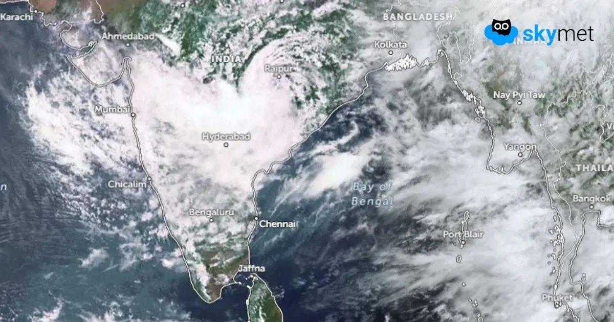
Key Takeaways:
- The monsoon depression is moving westward and will weaken into a low-pressure area over South Rajasthan and North Gujarat within 48 hours.
- Updated model guidance shifts the heavy rain corridor towards Gujarat, Konkan, North Madhya Maharashtra and adjoining Rajasthan.
- Flood-prone districts of Gujarat may receive another round of heavy rainfall through August 3.
- Weather conditions are expected to improve gradually across the region from August 4 onward.
- Forecast Validity: Next 3 to 5 days.
The monsoon depression over Odisha and Chhattisgarh has moved nearly westward and is now positioned over the adjoining parts of Central Chhattisgarh and East Madhya Pradesh. The cyclonic circulation associated with the system extends beyond 20,000 feet and tilts southward with height. The depression will move further westward, tracking along the border of Madhya Pradesh and Maharashtra. It is expected to gradually weaken into a low-pressure area over the adjoining parts of South Rajasthan and North Gujarat during the next 48 hours. Thereafter, the weakened system will move further north and merge with the seasonal monsoon trough extending along the Indo-Gangetic Plains.
The model projections have changed over the past 24 hours. Earlier, the system appeared likely to spare Gujarat, Konkan and South Rajasthan from the worst of the monsoon fury. However, the latest model run now drives the depression through the central parts and takes it towards the far end of the boundary between North Gujarat and South Rajasthan. As a result, the impact zone of the depression has shifted, allowing extreme weather activity to extend deep into North Madhya Maharashtra, Konkan, the interiors of Gujarat, and overlapping parts of Southeast Rajasthan and Southwest Madhya Pradesh.
The convergence zone of the monsoon depression is largely concentrated in its southwest sector. Intense weather activity is typically realised more effectively in the forward sector and southwest quadrant of the depression. In contrast, the rear section of the system and much of its northern half are likely to experience comparatively improved weather conditions. Consequently, the most vulnerable weather pockets will continue to shift as the depression moves along the pre-existing east-west-oriented shear zone, broadly aligned near 22°N.
Today, the areas at risk include Telangana, Vidarbha, parts of Marathwada, Southwest Madhya Pradesh and the southern fringes of Rajasthan. Tomorrow, hazardous weather will exit Vidarbha and Marathwada but will spread across Konkan, North Madhya Maharashtra, South Coastal Gujarat, the interiors of Central and North Gujarat, and adjoining parts of Saurashtra. The peripheral areas of South Rajasthan and Southwest Madhya Pradesh will continue to experience the remnant yet significant impact of the weather activity on 31st July.
The intensity and spatial coverage of rainfall are expected to reduce considerably on 1st August, but conditions will still be favourable for widespread rain across most parts of Saurashtra, Central Gujarat and bordering areas of South Rajasthan.
Fresh caution is advised for those parts of Gujarat that were inundated during the extreme weather activity a week ago. Several locations are likely to receive another round of heavy rain, including Bhavnagar, Botad, Anand, Kheda, Ahmedabad, Gandhinagar, Godhra, Panchmahal, Vadodara, Bharuch, Surat, Navsari, Vapi and Valsad. Moderate rainfall is likely over the remaining parts of the state. The remnant effect of the weather activity will persist for two more days, on 2nd and 3rd August. A broad clearance in weather conditions is expected from 4th August onwards.



