
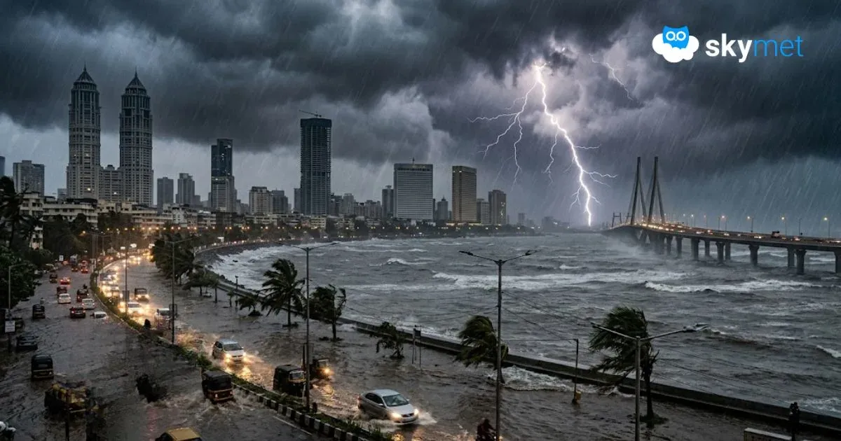
Heavy Rainfall Week For Mumbai: Flooding Rains Likely

Representational Image: AI-Skymet
Key Takeaways:
- Mumbai recorded 205 mm rainfall in 24 hours, marking the second-heaviest downpour of the season.
- The city has already received over 400 mm rainfall in the first four days of July.
- Extremely heavy rainfall is expected on July 4, 5, and 7 due to multiple active monsoon systems.
- Waterlogging, traffic jams, rail disruptions, and flight delays are highly likely across Mumbai.
- Forecast Validity: Next 5 to 7 days.
Monsoon activity has picked up over the Konkan region in general and Mumbai in particular. The airport observatory at Santacruz recorded 205 mm rainfall during the past 24 hours. This is the second-heaviest downpour of the season after the city registered 225 mm rainfall on 24th June 2026. The capital city had just managed to get closer to the normal rainfall for June 2026. Despite poor rainfall during the first half of the month, three-digit downpours twice in the last week helped the city score 516 mm monthly rainfall against the normal figure of 526.3 mm.
The month of July has started on the rainiest note and the city has recorded over 400 mm rainfall during the last four days. July is the rainiest month for the city with an average of 919.9 mm, and Mumbai receives 50% of its monsoon rainfall during this month.
A special feature of Mumbai during the monsoon is noteworthy, and that is, irrespective of El Niño or drought years, the month of July delivers. During the last El Niño year of 2023, the city recorded a deluge of 1771 mm rainfall in July, which is also the record highest for the month. The Santacruz observatory has persistently surpassed the average rainfall in July between 2018 and 2024. Last year, however, it fell marginally short and gathered a total of 790 mm rainfall.
Mumbai is in for the heaviest rainfall during the next seven days. Multiple factors are favourable for the likely deluge over the city and suburbs. An active offshore north-south trough is extending from South Gujarat to Coastal Karnataka. A strong westerly stream is meeting the Konkan Coast head-on. An extended shear zone is marked along 21 degrees, well within reach of the city limits. Also, a cyclonic circulation, as a prelude to the low-pressure area, is marked over the North Bay of Bengal.
This will strengthen the monsoon stream along the Western Ghats. Under the combined influence of these systems, the city will have heavy downpours on successive days between 02nd and 08th July 2026. Extremely heavy rainfall is expected on 04th, 05th, and 07th July.
The city will have a high tide twice during the 24-hour period. Today, the tide will occur in the afternoon around 1 p.m. and again at midnight. The timings will keep shifting by about 45 minutes on a daily basis. There is a strong possibility of heavy waterlogging in many areas, including roads and rail tracks.
Traffic is likely to be badly affected and commuters will face the brunt. Air operations are also likely to be impacted, and flights may get delayed, diverted, or even cancelled. The tarmac area of the aerodrome may become waterlogged. The inclement weather conditions will include strong gusty winds and blinding rain, making landings and take-offs risky. All water bodies are likely to become full to the brim and may even overflow. Overall, normal life is expected to be badly affected and, therefore, utmost caution is advised.
Trending:


