Well marked low over the Bay of Bengal: Unlikely To Strengthen; Monsoon Onset Over Andaman Sea shortly

Key Takeaways:
- Well-marked low-pressure area over the Bay of Bengal is moving northeastward away from Tamil Nadu and Andhra Pradesh coast
- System unlikely to intensify beyond a weak depression; tropical storm formation not expected
- Southwest Monsoon likely to reach Andaman Sea and Bay Islands around May 15, 2026 (+/- 1 day)
- Moderate to heavy pre-monsoon rain expected over Kerala, Tamil Nadu and South Interior Karnataka between May 15 and 18
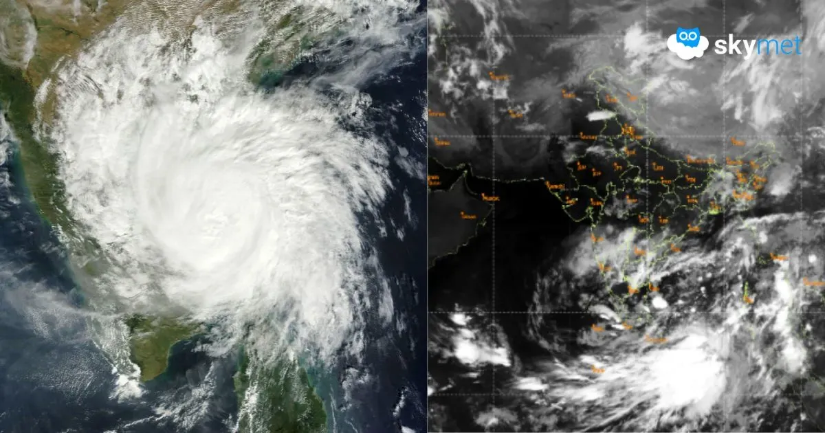
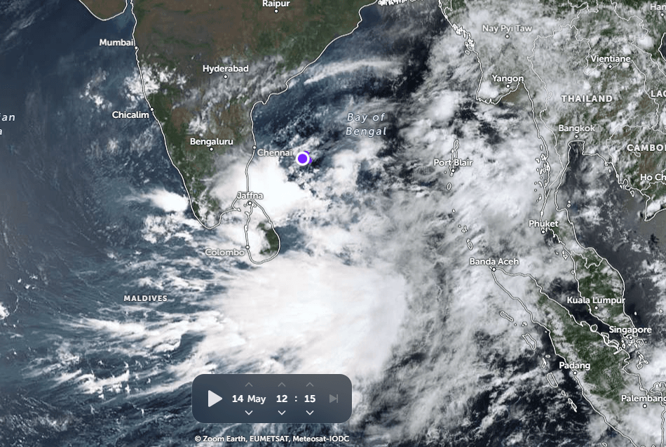
Yesterday’s low-pressure area over the Southwest and adjoining West-Central Bay of Bengal (BoB) moved northeastward and became a well-marked low pressure area. The system is centred over the deep sea, east of Chennai, and is likely to move further northeast, away from the coastlines of Tamil Nadu and Andhra Pradesh. Environmental conditions remain marginal. There is significant divergence among numerical weather models regarding the likely track and intensity of the system. Reliable indications suggest, at best, brief intensification into a weak depression, after which the system is expected to weaken. Despite the seasonal climatology, it is not likely to become a tropical storm and is expected to move further northeast over Central and adjoining Northeast Bay of Bengal during the next 36 hours.
The weather system will head towards the Arakan Coast of Myanmar and is likely to make landfall tentatively late on May 16, 2026. Heavy to very heavy rainfall is expected over coastal parts of Myanmar, extending up to the Gulf of Martaban. Heavy rainfall will lash the entire north-south chain of Bay Islands, from Nan Cowry to Maya Bandar, including Car Nicobar and Port Blair. This system will strengthen the cross-equatorial flow, and a strong stream of southwesterly winds will sweep across the South and North Andaman Sea. Under its influence, the onset of Southwest Monsoon is likely over the Andaman Sea and Bay Islands around May 15, 2026 (+/- 1 day).
The shift of the low pressure area away from the East Coast will restore the normal pre-monsoon weather pattern over the South Peninsula. The seasonal north-south peninsular trough will re-establish from tomorrow onward. The trough will extend from Chhattisgarh to the southern tip of Kerala and Tamil Nadu, passing through Telangana, Interior Karnataka and Rayalaseema. The southern half of the trough will remain more active due to the close proximity of water bodies on either side of the coastline.
Active pre-monsoon conditions are expected over Tamil Nadu, Kerala and South Interior Karnataka. Moderate to heavy showers are likely over Bengaluru, Mysuru, Mandya, Coimbatore, Ooty, Trichy, Madurai, Thanjavur, Tirupur, Palakkad, Idukki, Kottayam, Kollam, Punalur and Alappuzha between May 15 and May 18, 2026.