Depression Over Bay Of Bengal Moves Closer: Heavy Rains Over Tamil Nadu Likely

Key Takeaways
- The depression is moving west-northwest toward Sri Lanka and is unlikely to intensify further.
- Rough weather with strong winds and heavy rain is expected along Sri Lanka’s east coast.
- Heavy rainfall is likely over south coastal Tamil Nadu between January 9 and 11.
- Interior Tamil Nadu and parts of Kerala may receive light to moderate rain.
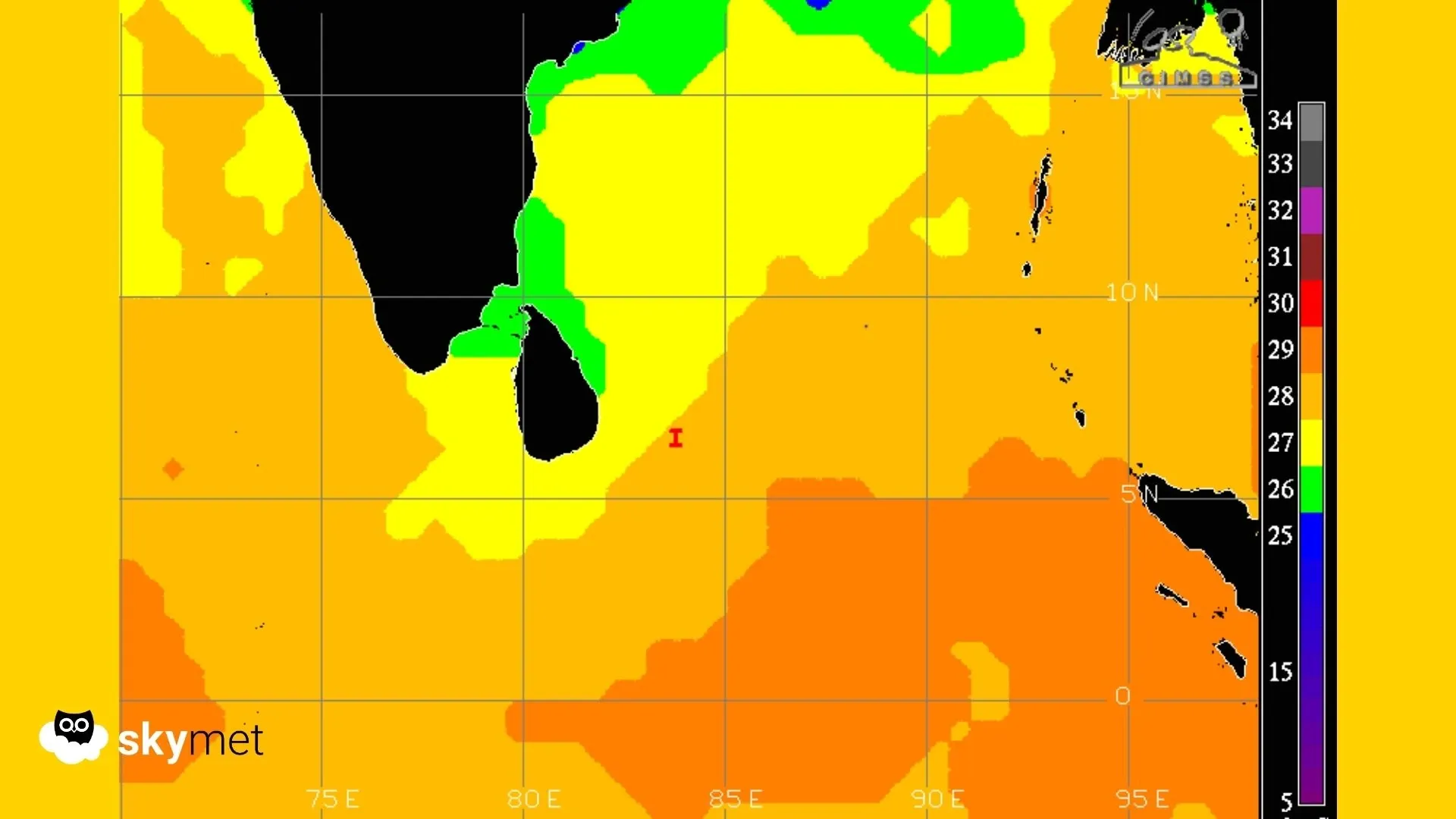
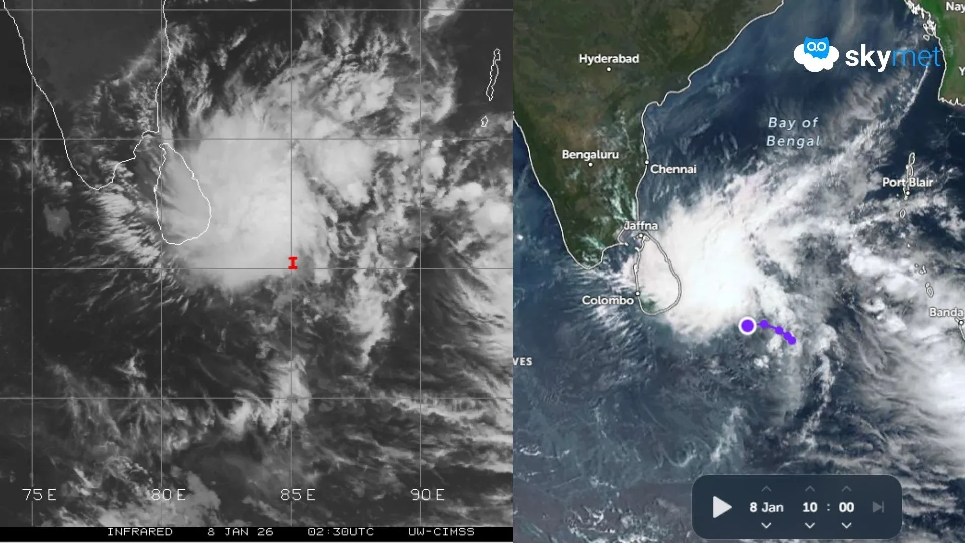
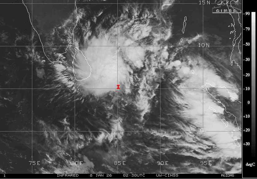
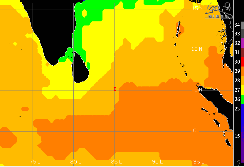
Yesterday’s depression over the Bay of Bengal moved west-northwest and got closer to the east coast of Sri Lanka over the southwest Bay of Bengal and adjoining equatorial region. The system is currently centered around 5.4°N and 85°E, about 750 km east-southeast of Colombo. The low latitude of the system, close to the equator, is considered detrimental for its growth and sustenance. The system will continue moving west-northwest and is likely to cross the Sri Lanka coast by tomorrow evening. The peripheral influence of the depression will affect weather conditions over south coastal Tamil Nadu. Earlier, the island nation was severely battered by Cyclone Ditwah during November 26 to December 3, 2025.
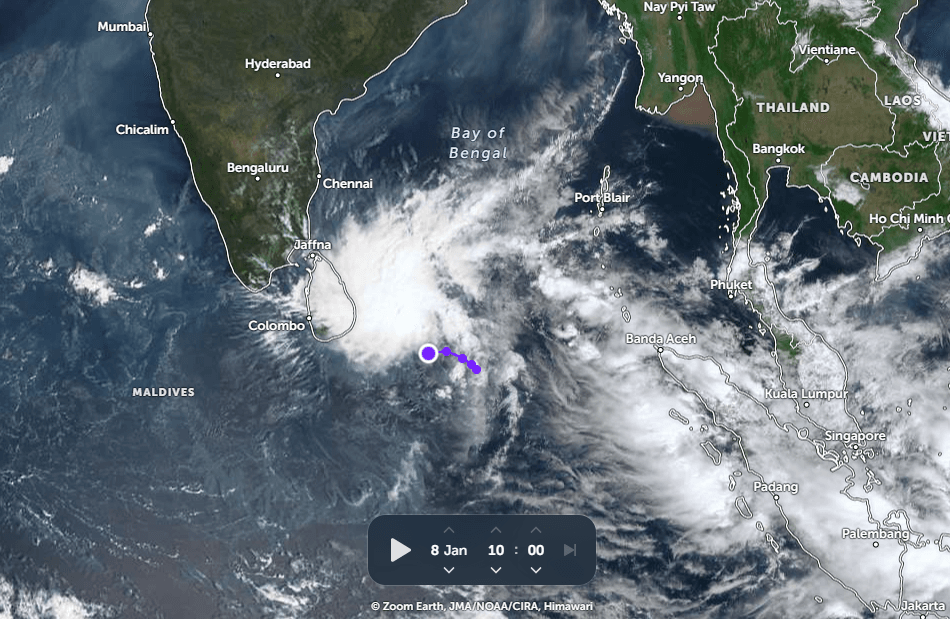
The winds in the inner core are estimated to be around 30 knots (55 kmph), and the system is showing signs of consolidation. However, the low-level cyclonic circulation remains elongated and somewhat obscured. As the system continues its west-northwest movement, it will approach relatively cooler waters of the Gulf of Mannar, Palk Strait, and the eastern coast of Sri Lanka. The surrounding environment appears only partially favourable for further development, and the potential for intensification into a significant tropical cyclone over the next 36 hours remains low.
As the system moves closer, the east coast of Sri Lanka, including Colombo, Hambantota, Kalmunai, Batticaloa, Trincomalee, and Vavuniya, is likely to experience rough weather conditions. Strong winds, heavy rainfall, and rough sea conditions may disrupt commercial and marine activities in the region.
After crossing the eastern coast of Sri Lanka, the system is expected to weaken, with its remnants entering the Gulf of Mannar. During this phase, heavy rainfall is likely over coastal parts of south Tamil Nadu. A north–south belt of inclement weather may affect Kanyakumari, Nagercoil, Tuticorin, Pamban, Tondi, Thoothukudi, and adjoining areas. These regions should exercise caution between January 9 and January 11, with higher impact expected during the first two days. Light to moderate rainfall may also extend to interior parts of Tamil Nadu and adjoining regions of Kerala during this period.