Weather update and forecast for January 10 across India


KEY TAKEAWAYS
- A deep depression over the Bay of Bengal is set to cross Sri Lanka on January 10.
- Heavy to very heavy rainfall is likely over Tamil Nadu and parts of Kerala.
- Dense fog and cold day conditions persist across north and northwest India.
- Minimum temperatures may gradually rise over central India.
The weather system over the country:
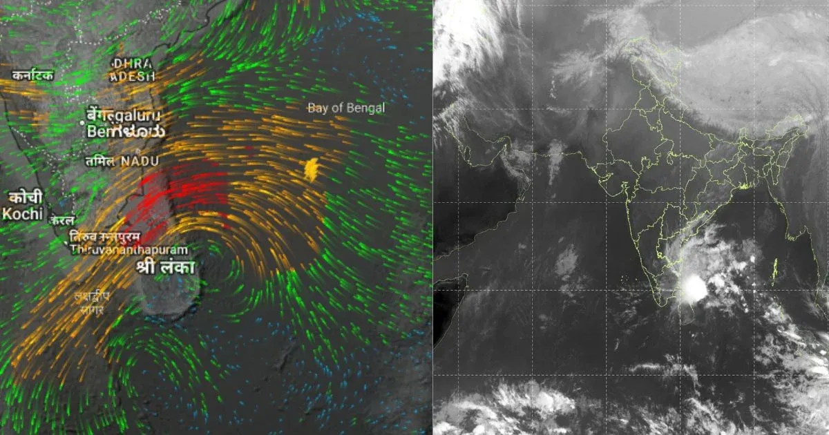
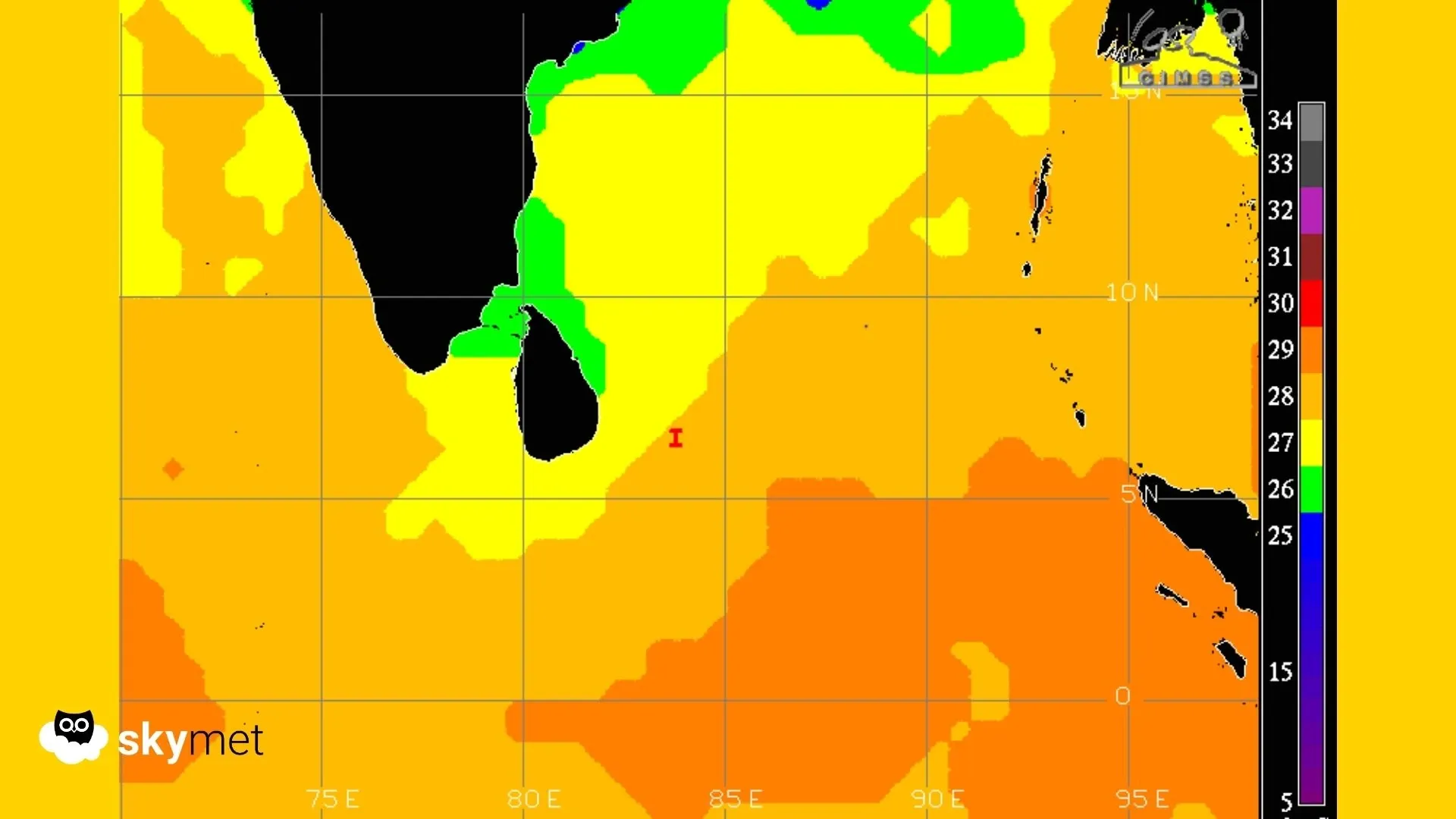
The deep depression over the southwest Bay of Bengal has moved in a northwest direction at a speed of about 10 kmph during the past six hours and lay centred at 05:30 hrs IST today, January 9, near latitude 7.1°N and longitude 83.3°E. The system was located about 160 km east of Pottuvil (Sri Lanka), 190 km east-southeast of Batticaloa (Sri Lanka), 260 km east-northeast of Hambantota (Sri Lanka) and 280 km south-southeast of Chennai (Tamil Nadu). It is likely to continue moving northwestwards and cross the north Sri Lanka coast between Trincomalee and Jaffna around noon on January 10.
A western disturbance is seen as a trough in the lower and middle tropospheric westerly winds, with its axis at about 5.8 km above mean sea level, running roughly along longitude 71°E to the north of latitude 30°N.
Another western disturbance, seen as a cyclonic circulation over north Punjab and adjoining areas, has merged with the above western disturbance.
An induced cyclonic circulation lies over Haryana.
The subtropical jet stream, with core winds of the order of 130 knots at about 12.6 km above mean sea level, prevails over northwest India.
A cyclonic circulation is present over Assam.
Another cyclonic circulation lies over the southeast Arabian Sea and adjoining south Kerala coast, extending up to about 1.5 km above mean sea level.
Weather Activity in the last 24 hours:
During the last 24 hours, light rain occurred over south Haryana, Delhi NCR, northeast Rajasthan and coastal Tamil Nadu.
Light to moderate rain occurred over the Andaman and Nicobar Islands.
Very dense fog was observed at many places over east Uttar Pradesh and parts of west Madhya Pradesh.
Dense fog occurred at most places over west Uttar Pradesh, at a few places over east Madhya Pradesh, and at isolated places over Bihar and west Rajasthan.
Cold day conditions prevailed over many parts of Punjab, Haryana and Uttar Pradesh, and parts of north Rajasthan and north Madhya Pradesh.
Forecast for the next 24 hours:
During the next 24 hours, heavy rainfall accompanied by thunderstorms and lightning may occur at isolated places over Tamil Nadu during January 9 to 11 and over Kerala on January 10. Isolated very heavy rainfall is possible over Tamil Nadu on January 10.
Minimum temperatures are likely to increase gradually over central India during the next two to three days.
Dense to very dense fog conditions may occur during morning hours in isolated pockets of Punjab, Haryana and Uttar Pradesh.
Cold day conditions are possible in isolated pockets of Uttarakhand, Punjab, Uttar Pradesh, Sub-Himalayan West Bengal, Sikkim, Haryana and Rajasthan on January 8 and 9.
Ground frost conditions may occur at isolated pockets of Uttarakhand, Meghalaya and Rajasthan on January 8 and 9.
Do not miss:
Any information picked from here must be attributed to Skymet!