CMIC Cloud Top Phase, Courtesy: Mosdac.gov.in
KEY TAKEAWAYS:
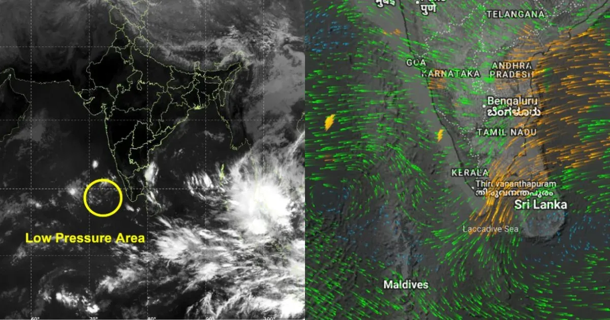
- A low-pressure area is set to form over the Southeast Bay of Bengal around 21–22 November, likely intensifying into Cyclone Senyar.
- Tamil Nadu, Andhra Pradesh, and Odisha may face potential landfall threats between 27–29 November.
- Sea conditions—high heat potential and favourable wind shear—support rapid strengthening.
- Reliable forecasts will emerge after 24 November once the system reaches depression/deep depression stage.
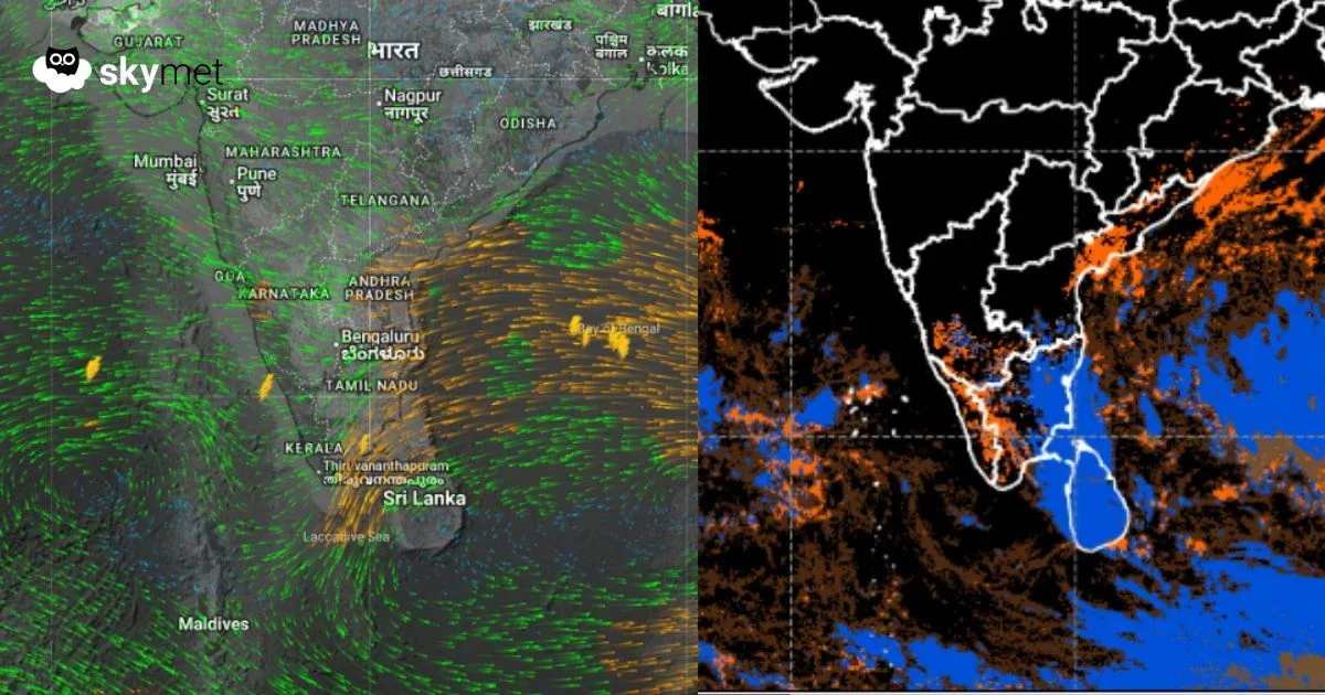
As predicted earlier, a low-pressure area is likely to form over the Southeast Bay of Bengal (BoB) and adjoining South Andaman Sea late on 21st or early on 22nd Nov 2025. After inception, the system will keep gathering strength to intensify into a depression first and quickly transform into a cyclonic storm over the south-central parts of the BoB. The storm is expected to head for the East Coast, keeping Tamil Nadu, Andhra Pradesh, and Odisha on tenterhooks for a potential strike, tentatively between 27th and 29th Nov 2025. Precise details about the storm will be authentic after the system reaches the stage of depression/deep depression anytime around 24th Nov 2025.
This will be the second storm of the post-monsoon season over the Bay of Bengal. Earlier, severe cyclonic storm Montha struck Andhra Pradesh in the last week of October 2025. The sea conditions seem favourable for intensification, in terms of heat potential and wind shear. Weather systems forming over the North Andaman Sea and adjoining BoB have a track record of striking Odisha and West Bengal around this time of the year. However, this weather system is forming in close proximity to the equatorial region and will, therefore, stand increased chances of heading for Tamil Nadu and Andhra Pradesh.
The storm, as and when it forms, will be named ‘Senyar’ as proposed by the member country United Arab Emirates. The name will be pronounced as Sen-Yaar. The system will have a long sea travel and is, therefore, vulnerable to gain severity and spread. After emerging as a low-pressure area, the weather system will turn into a significant depression over the south-central BoB around 23rd/24th Nov and quickly reshape into a cyclonic storm by 25th/26th Nov 2025. As model reliability degrades after a lead time of 4–5 days, the exact prognostication will be possible by the end of this week. As such, these storms are known to be notorious for defying norms. The track, intensity, and timelines will be shared with adequate notice at the start of next week.
METHODOLOGY
This assessment is developed using continuous monitoring of real-time and historical meteorological data, ground observations, radar scans, satellite imagery, numerical models, and long-term climatology.
Forecast Interpretation Framework
The forecast interpretation relies on synoptic chart analysis to assess the presence or absence of western disturbances, cyclonic circulations, and plains-level features. Numerical Weather Prediction (NWP) model outputs, including ECMWF, GFS, and Skymet’s in-house ensemble models, are evaluated alongside wind-field behaviour and evolving atmospheric signals to understand system development and temperature trends.
Numerical Weather Models
Forecasts are validated against a suite of global and regional models, including:
• Global models: GFS, ECMWF, UKMET, ICON
• High-resolution regional models: WRF, HARMONIE-AROME, and proprietary AI-based ensemble systems
Key diagnostic fields analysed include pressure patterns, vorticity, humidity layers, vertical velocity, wind shear, stability indices (CAPE–CIN), and ensemble spreads to evaluate model consistency and forecast reliability.
Cross-Verification & Expert Insight
Model guidance is cross-checked with real-time radar and satellite behaviour, supported by climatological trends, field reports, and historical pattern recognition. This ensures that forecasts reflect both observational truth and real-time atmospheric evolution.