Pre-Monsoon Showers-Early Activity Over East And Central Parts

Key Takeaways:
- Pre-monsoon transition is beginning over central and southern India.
- Thunderstorm activity will commence from 22nd Feb over Vidarbha, Marathwada, and South Chhattisgarh.
- Activity will intensify on 23rd Feb across Chhattisgarh, Odisha, and adjoining states.
- Showers will persist over peninsular interiors until 26th Feb, with Kerala seeing isolated activity into early March.
The transition period from winter to pre-monsoon starts anytime after the second half of February. Climatologically, the pre-monsoon is counted from March to May, but there are incidents of early start of the activity. This is more applicable for the southern and central parts of the country. Something similar is coming up over these parts starting early next week.
The wind pattern is getting jumbled up over the central and eastern parts anytime soon. The anticyclone has been pushed and placed over the Chhattisgarh and Odisha region. Another cell is coming up over the Northeast Arabian Sea, off the Konkan and Gujarat coast. In between, the airflow is fragmented. There is nothing new in this pattern and it normally appears at the changeover time over central parts.
The positioning of these two anticyclones is such that it forms a convergence zone in the middle. The fluid dynamics make the zone oscillate left and right. The anticyclone over Chhattisgarh and Odisha pushes the moist air from the sea deep inland. This becomes a regular feature and triggers frequent thunderstorm activity, more actively along the coastline of Odisha.
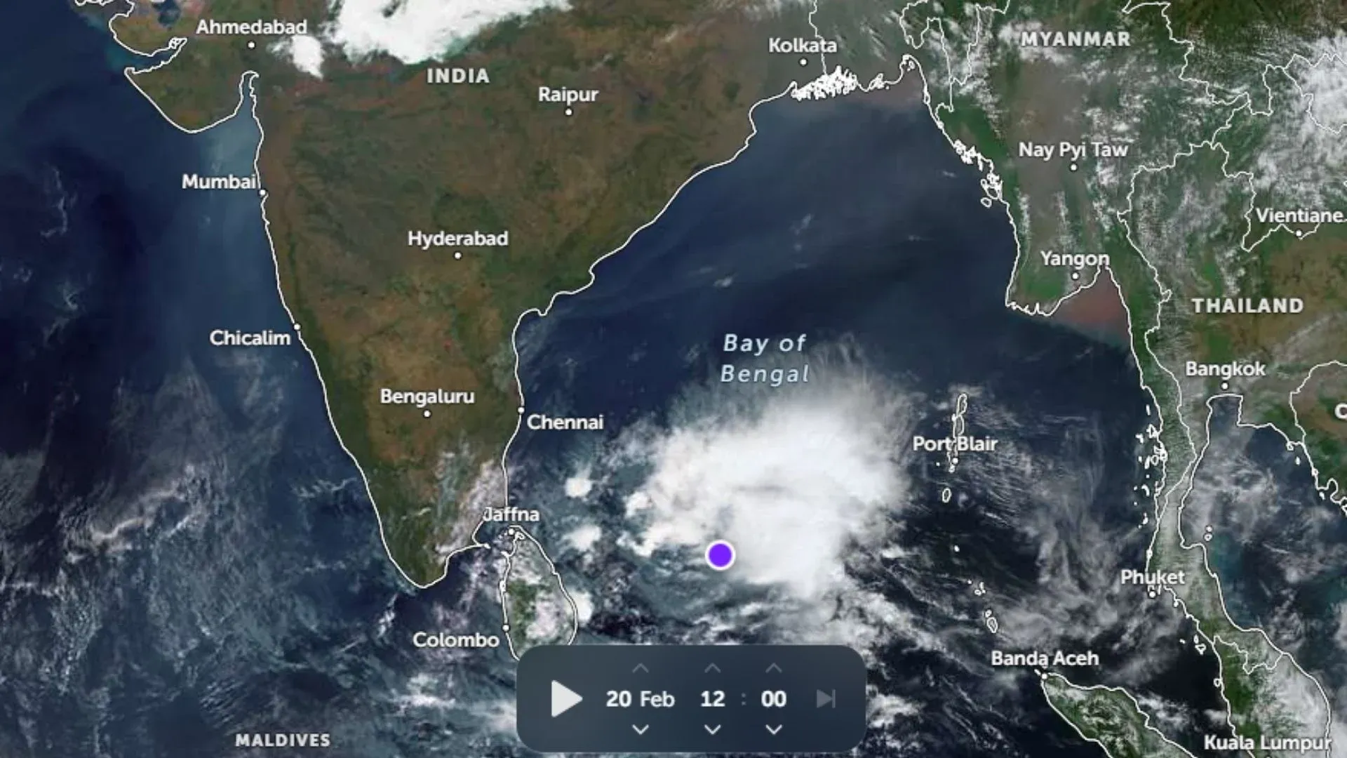
In the current scenario, light and scattered activity will start over Vidarbha, Marathwada, and South Chhattisgarh on 22nd Feb. The spread and intensity will increase to cover the whole of Chhattisgarh, large parts of Odisha, and some pockets of Jharkhand and West Bengal on 23rd Feb 2026. Peninsular India, as such, will have weather activity associated with the low-pressure area over the Southwest Bay of Bengal and the equatorial region between 21st and 23rd Feb. The two ends of weather activity will connect to increase the spread and scale further, and extend to cover parts of Telangana and interior Karnataka.
While the thunderstorm activity will vacate the central and eastern parts on 25th Feb, the interiors of Peninsular India will continue with pre-monsoon showers on 25th and 26th Feb 2026. Light and isolated activity may continue further over Kerala for two more days before it is called off completely at the start of March.