Twin Low-Pressure Area Over Bay Of Bengal: Weeklong Weather Activity Over South India

Key Takeaways:
- Two low-pressure systems over the Bay of Bengal will move west-northwest in tandem.
- Sri Lanka continues to receive heavy rainfall, with Pottuvil recording 98 mm in 24 hours.
- Rain activity will increase across Tamil Nadu, Kerala, and Karnataka between 21st and 23rd Feb.
- Weather activity will gradually shrink to Kerala by 26th–27th Feb before clearing in early March.
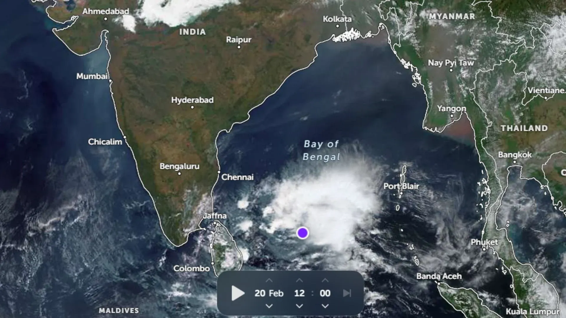
The low-pressure area over the Southwest Bay of Bengal (BoB) and the adjoining equatorial region persists. The cyclonic circulation is extending up to about 20,000 feet. It is likely to move west-northwest towards Sri Lanka. In the meantime, another cyclonic circulation has come up over the Southeast BoB and the neighbouring equatorial region. Under its influence, another low-pressure area is likely to form over the same region in the next 24 hours. This system will also move west-northwest, like the earlier one, and track the same course. The two weather systems will move in tandem and keep the weather activity going over South India for nearly one week.
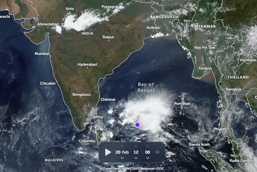
The southeast coast of Sri Lanka has been battered for the last 4–5 days. Earlier, Batticaloa had very heavy rainfall and now Pottuvil has received 98 mm rainfall in the past 24 hours. Kandy and Badulla are a few other stations getting frequently bashed, and this is going to continue. The weather activity will extend to the southern states like Tamil Nadu, Kerala, and Karnataka till late next week.
Light and isolated weather activity will commence over coastal parts of Tamil Nadu today. For the next three days, between 21st and 23rd Feb, the scale and spread of activity will increase south of the Chennai–Bengaluru–Mangalore axis, running around 13°N. Over the next two days, the intensity will reduce but the spread will increase to cover parts of South Interior Karnataka, Rayalaseema, Tamil Nadu, and Kerala. Bengaluru and Chennai stand a chance to have rains during this period. The weather activity will shrink on 26th and 27th Feb and remain confined to Kerala before getting broad clearance at the start of March.