La Nina Cooling Starts Crashing: ENSO-Neutral Draws Closer

Representational Image: AI-Skymet
Key Takeaways:
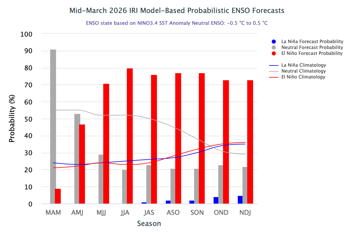
- La Niña continues to weaken, with a transition to ENSO-neutral likely by May 2026
- Sub-surface warming supports the increasing probability of a strong El Niño
- El Niño intensity depends on SST anomalies, with >+2°C indicating very strong events
- El Niño combined with negative IOD could adversely impact the Indian monsoon
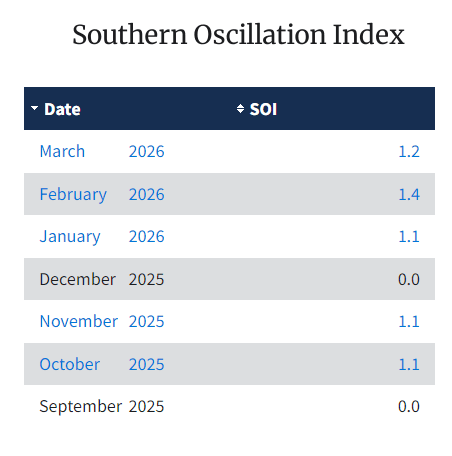
The already weak La Niña conditions had continued to decline in oceanic aspects, while atmospheric features were delicately lagging to catch up with the pace. The Southern Oscillation Index, representing the atmospheric arm, has weakened slightly. The average value of SOI for the month of March remains positive, but with a drop in magnitude. It is suggestive of further fading of the already dying La Niña and a quick changeover to ENSO-neutral. Historically, ENSO-neutral follows after La Nina has a brief stint and leads to a rapid transition to El Niño.
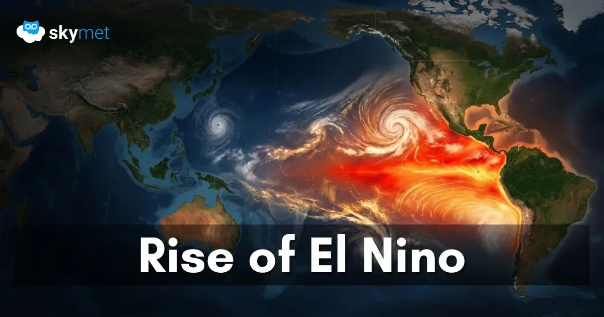
Warmer sub-surface waters now dominate much of the basin. Taken together, these conditions signal the surrender of La Nina in the central-eastern equatorial Pacific, in favour of ENSO-neutral, with an increased chance of strong El Nino development. There are all sorts of prefixes getting attached to the phenomenon like ‘Super El Nino’, ‘Monster El Nino’, ‘Godzilla El Nino’, and so on. Scientifically, no such terminology finds evidence in the formal presentations related to this recurring phenomenon. “Super El Nino” is primarily an informal media-driven term used to describe an exceptionally strong El Nino event, rather than an official scientific designation from organizations like NOAA. While “Super El Nino” is not a formal classification, it serves as a useful descriptor for a rare, high-intensity event.
Scientifically, these extreme events are categorized using specific metrics. El Nino could be classified further depending upon the degree of warmth in the oceanic basin. The informal term ‘Super El Nino’ may be equated with ‘Very Strong El Nino’, typically occurring when sea surface temperature anomalies in the central-eastern Pacific (Nino 3.4 region) exceed +2.0°C above the long-term average. A strong El Nino refers to the temperature anomaly between +1.5°–1.99°C. The anomaly between +1°–1.49°C is considered ‘moderate’ El Nino, and anything lower than that may be termed as ‘mild’ El Nino.
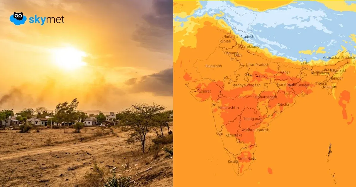
ENSO: There are confirmed indications of El Nino coming up in the summer monsoon and growing to become increasingly rogue during the fall of the year. It becomes the rarest of rare events in dimensions. This will speed up the pace of global warming, albeit with a lag of about 3–4 months. It is quite likely to redraw the global weather pattern, sparking floods in some areas and droughts over a few other pockets. The likely impact of the event will necessitate strategic thinking to absorb the ill effects. While there are no means to make a region ‘drought free’, with adequate lead time, it is possible to prepare for ‘drought resilience’.
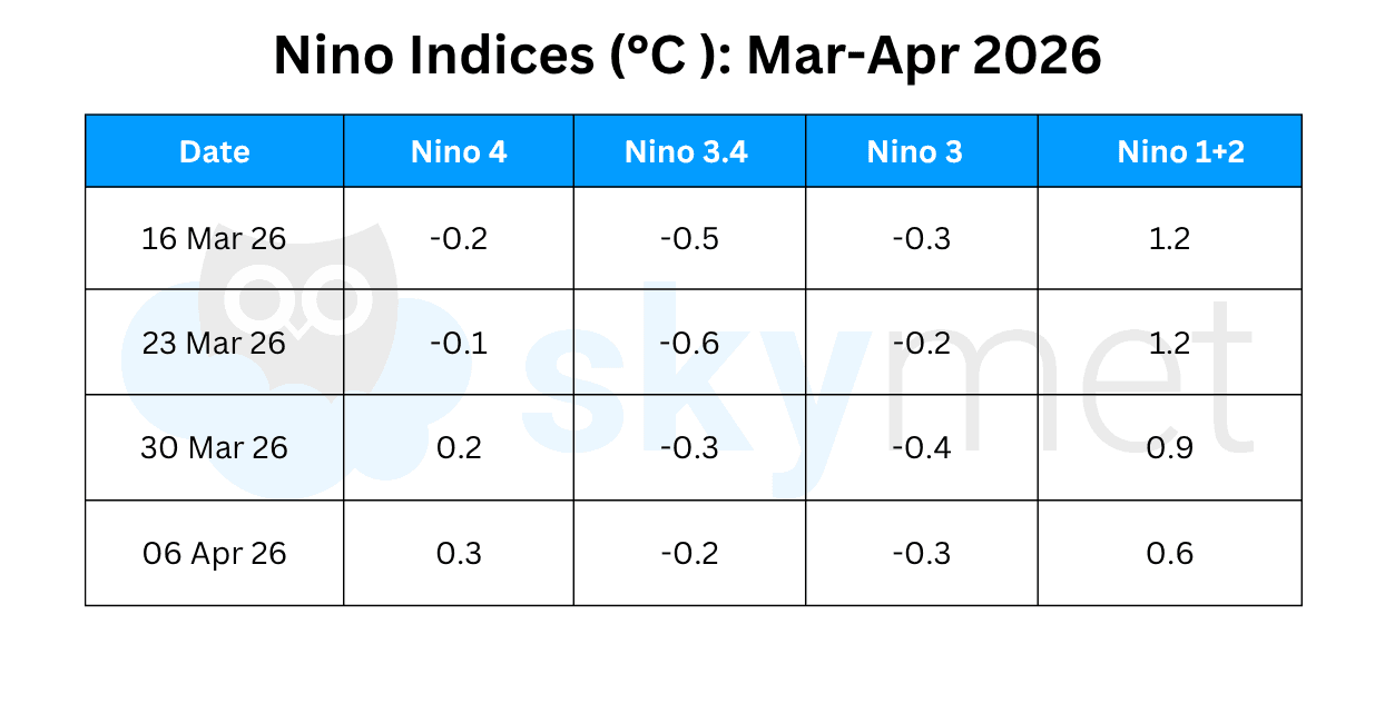
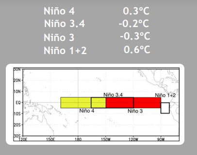
The flanks of the Nino region have started warming more than the rest. Due to sub-surface warming and its eastward progression, the Nino 1+2 index has gradually increased. The index has remained above the threshold of +0.5°C for the last eight weeks. Also, it breached the 1°C mark for two consecutive weeks. The Nino 3.4 index, otherwise the coolest of all, has also begun declining rapidly. It has reached the lowest cool anomaly of -0.2°C during this week. Continuation of this pattern for the next 3–4 weeks will facilitate transition to ENSO-neutral, more likely in May 2026.
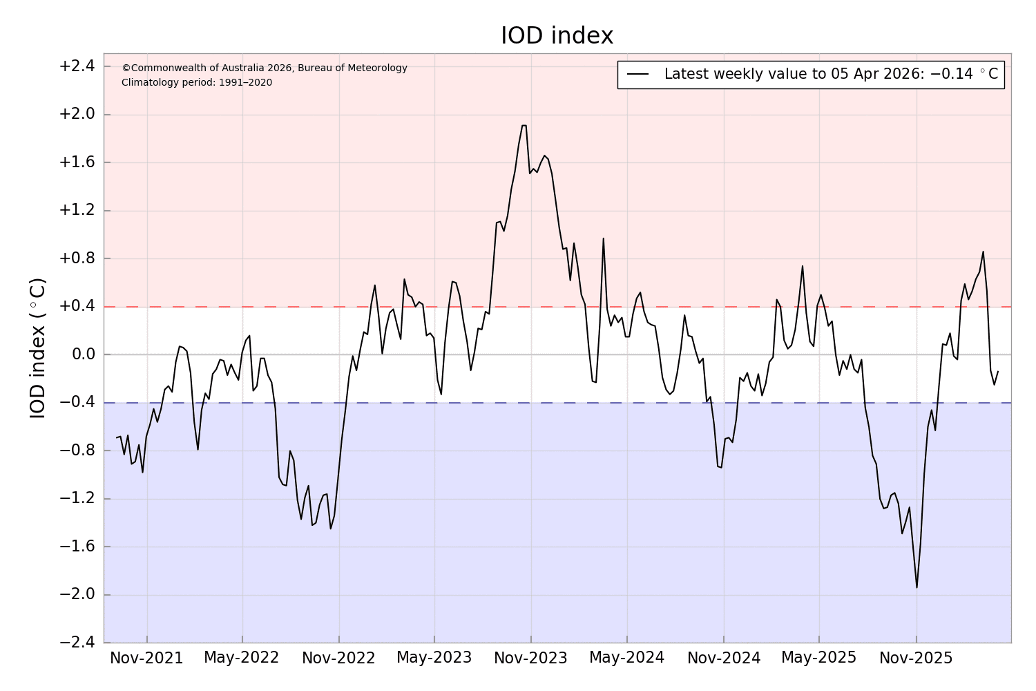
IOD: As of April 2026, the Indian Ocean Dipole has remained in a neutral phase. Some forecasts suggest a potential shift towards a negative IOD event in the coming summer months. A negative IOD typically features warmer waters in the eastern Indian Ocean, impacting rainfall in Australia and Southeast Asia. Historic records support that El Nino conditions are more often accompanied by neutral or positive IOD. The combination of El Nino and negative IOD is considered disastrous for the Indian Summer Monsoon. The IOD index has remained negative neutral for the last three weeks. The latest index value for the week ending 05th April was -0.14°C.
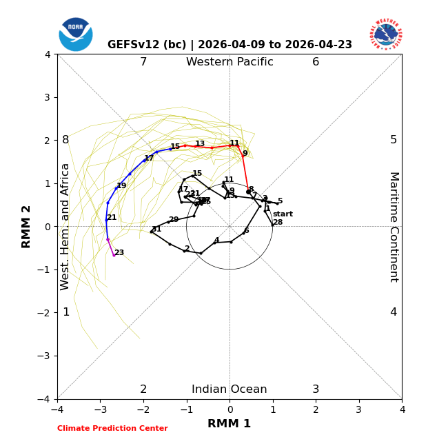
MJO: Madden-Julian Oscillation has exited Phase-6 of the Western Pacific and is currently sailing over the far end of the Western Pacific in Phase-7. The dynamical models indicate a fast-moving MJO propagation eastward over the Western Hemisphere during mid to late April. Climatologically, April tends to be a quiet time of the year for tropical cyclones. Based on support from the GEFS and ECMWF models, along with MJO composites, the chances of tropical cyclone development over the Indian seas are minimal in April.
Spotting an El Nino formation provides an early heads-up on changing risks for many weather-related phenomena. There is still a lot of uncertainty around the upcoming El Nino, including a range of forecast outcomes. Gauging its intensity continues to be a challenge, and authentic forecasts will have to wait for the spring prediction barrier to get over.
Trending: