Depression Weakens To Low Pressure Area: Weather Conditions To Improve Over Tamil Nadu Tomorrow

Key Takeaways
- The depression off the north Tamil Nadu coast weakened into a well-marked low but maintained an unusual southwestward track.
- Moderate to heavy rainfall lashed Tamil Nadu and south coastal Andhra Pradesh, with Tondi recording 95 mm.
- The system remains nearly stagnant over north–central Tamil Nadu and Puducherry–Karaikal.
- Rain is expected over Chennai, Puducherry, Karaikal, Cuddalore and south coastal Andhra Pradesh for the next 24 hours before easing.
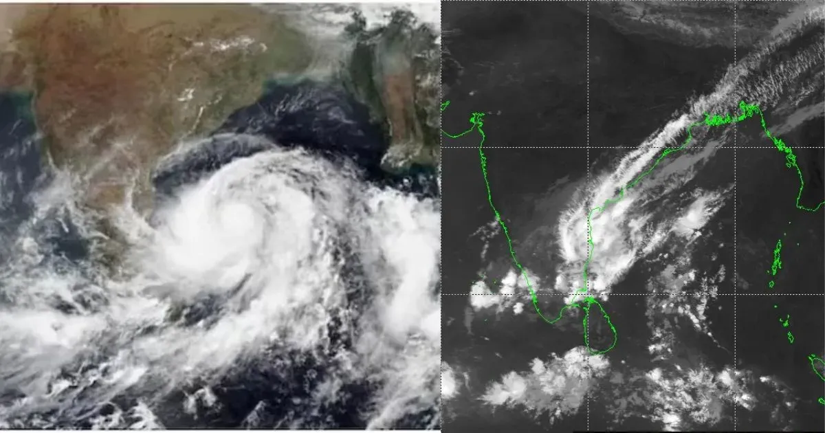
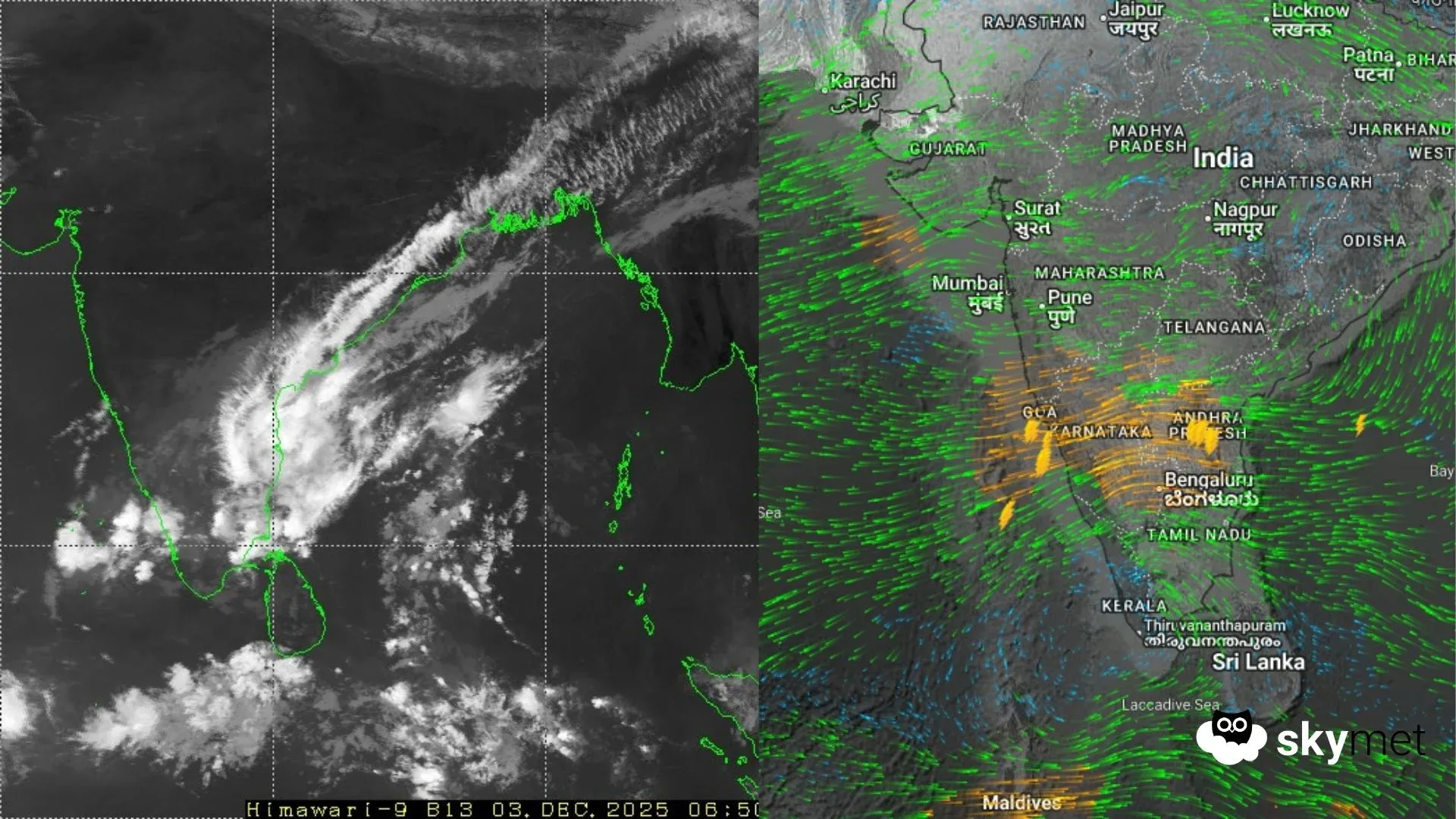
The depression over the southwest Bay of Bengal, off the north Tamil Nadu coast, moved southwest very slowly. The depression has weakened into a well-marked low-pressure area and is lying over the coastal parts of north Tamil Nadu and Puducherry. The cyclonic circulation extends up to mid-tropospheric levels. In a very unusual course, the system maintained the southwesterly track for over 24 hours and will continue the same, predominantly over inland portions of the state. Despite the weakening of the system, moderate to heavy rainfall continued in the past 24 hours, more aggressively along the coastline.

The chief amounts of rainfall in the past 24 hours include: Tondi – 95 mm, Karaikal – 70 mm, Nungambakkam – 51 mm, Meenambakkam – 30 mm, Puducherry – 20 mm. South coastal Andhra Pradesh also received moderate to heavy rainfall. Nellore recorded 88 mm and Kavali about 33 mm during the same period. Scattered showers were reported over the interiors of Tamil Nadu, Kerala, Rayalaseema and south interior Karnataka. Similar conditions are likely for the next 24 hours and will ease thereafter.
The well-marked low-pressure area now lies over the coastal parts of north and central Tamil Nadu and the Puducherry–Karaikal region. The system is nearly stagnant over the region and is likely to shift southwest, if at all, covering only a minuscule area of the state’s interiors. A northeast–southwest oriented cloud cluster remains over Tamil Nadu and south coastal Andhra Pradesh, more prominently along the coastline. Chennai, Puducherry, Karaikal, Cuddalore, Nagapattinam, Tiruvallur, Kanchipuram, Vellore, Nellore, Ongole and Bapatla are expected to receive moderate rainfall and heavy showers at places in the next 24 hours. The system's persistent stay over land will weaken and erode its configuration. It will become a weak low-pressure area by late evening today. However, the remnant circulation will keep light weather activity going over the southern parts for the subsequent 48 hours.