Low Pressure Moves Northeast Over Bay: Heavy Rainfall Over Bay Islands And Monsoon Onset Likely


Key Takeaways:
- Low pressure area over Bay of Bengal may intensify into a depression within 48 hours.
- The system is expected to move towards Myanmar-Arakan Coast, away from India’s East Coast.
- Southwest Monsoon is likely to reach Andaman Sea around May 15, nearly a week early.
- Very heavy rainfall and flooding rains are expected across Bay Islands between May 14 and 16.
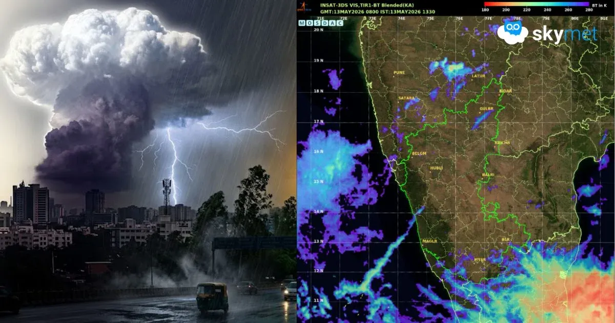
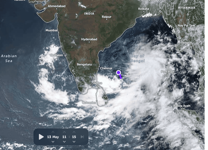
The low pressure area over the Southwest Bay of Bengal (BoB) has moved northeastward and is now marked over the Southwest and adjoining West-Central Bay of Bengal. It is likely to become a well-marked low pressure area shortly and move further northeastward, away from the East Coast. Favourable sea surface temperatures along with adequate heat potential may upgrade the system into a depression during the next 48 hours. Moving further northeastward, the system is likely to head towards the Myanmar-Arakan Coast, dumping heavy to very heavy rainfall over the approaching weekend.
As the system is drifting away from the East Coast, no stormy conditions are expected over mainland India. However, there is a likelihood of scattered rain and thundershowers with isolated heavy falls at a few places over Tamil Nadu and Kerala. Heavy to very heavy rainfall will remain confined to the deep sea areas of the Bay of Bengal. Bay Islands have already received moderate showers across Nan Cowry, Carnic, Port Blair, Hut Bay and Maya Bandar. Very heavy flooding rains are expected across the entire chain of Bay Islands between May 14 and May 16, 2026.
There are no strict parameters or specifications for announcing the onset of the monsoon over the Andaman Sea and Southeast Bay of Bengal. Courtesy of the low pressure area over the Bay of Bengal, a strong cross-equatorial flow has developed, which is an essential marker for dragging the monsoon into the region. Coupled with the likely widespread rainfall activity, the southwest monsoon onset is expected anytime around May 15, 2026 (+/- 1 day).
This is likely to be a repeat of last year, when the monsoon arrived over the South Andaman Sea on May 13, almost a week before the stipulated date. Normally, there is a gap of about 10 days for the monsoon to reach mainland Kerala. However, this is not sacrosanct and has hardly any strong correlation. As of now, the Arabian Sea and the states of Kerala and Karnataka remain strictly under a pre-monsoon weather pattern.
A strong ridge persists over the central and southern parts of the Arabian Sea in the lower levels. This ridge needs to weaken to facilitate cross-equatorial flow over the Arabian Sea branch. At present, the low-level winds are weak northerlies along the coastlines of Kerala and Karnataka. For monsoon onset, strong southwesterly winds need to sweep across the Southeast Arabian Sea, Lakshadweep Islands, Comorin area and Maldives region. Last year, the southwest monsoon arrived on May 24, nearly a week ahead of its normal onset date, and covered major parts of South Peninsula, including the entire Tamil Nadu, Kerala and parts of Coastal and South Karnataka.
Trending: