The oceanic parameters impact global and regional weather conditions. For the Northern Hemisphere in general and the Indian subcontinent in particular, three parameters have a strong correlation with climatic patterns: ENSO, IOD, and MJO. The El Niño/La Niña in the equatorial Pacific have a teleconnection with the Indian subcontinent, whereas the Indian Ocean Dipole has a direct bearing on the South Asian countries. While ENSO and IOD are relatively static phenomena, the MJO is a transiting pulse that moves around the globe, showing the largest intra-seasonal variability.
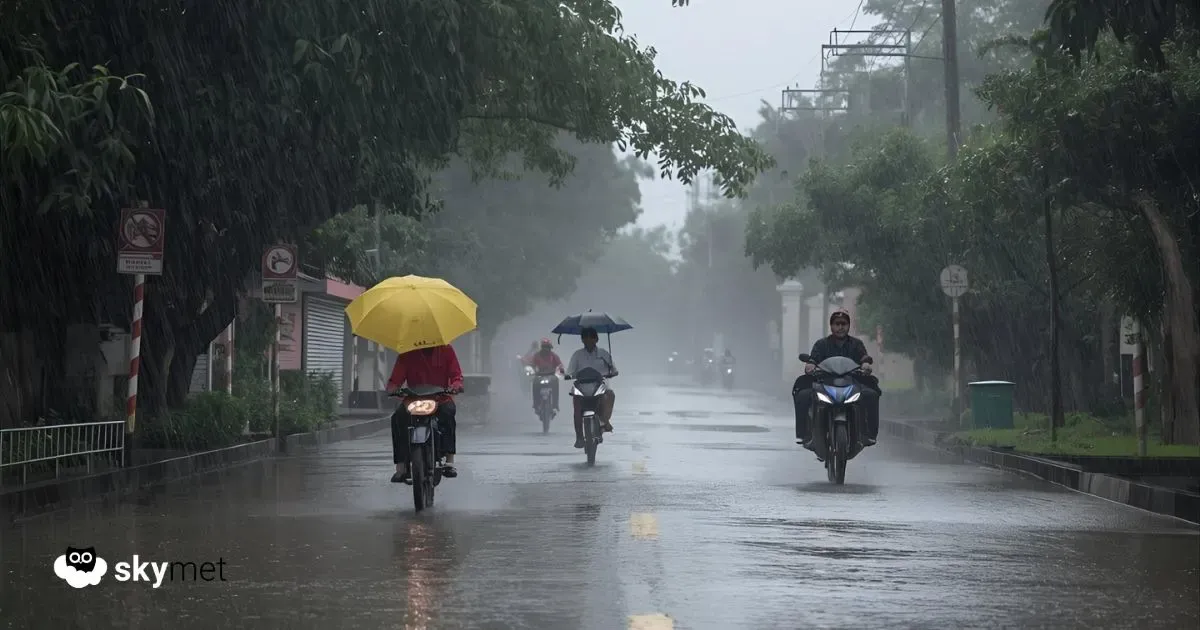
A negative IOD can lead to a weaker, less consistent Northeast Monsoon, which is responsible for rainfall in South India. In this phase, the western Indian Ocean cools while the eastern parts (close to Indonesia and Australia) warm, disrupting normal moisture-carrying winds and leading to below-average rainfall in affected areas. This negative IOD can also suppress equatorial disturbances like easterly waves, which predominantly control Northeast Monsoon rainfall. Climatic models indicate a strong negative IOD event through the post-monsoon season, suggesting the potential for a weaker Northeast Monsoon.
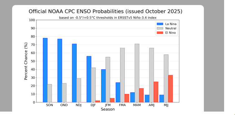
ENSO: During La Niña, the surface cooling of the equatorial Pacific is caused by intensified trade winds that churn cold water from beneath the ocean surface. During strong cooling of the Niño 3.4 region, even a mildly favorable atmospheric response (SOI) may suffice for the continuation of a La Niña event. However, a soft atmospheric reaction and lenient cooling of the ocean surface together may not be enough to trigger even a weak La Niña condition in the equatorial Pacific. Suppressed convection due to cooler temperatures may fail to induce large atmospheric waves to communicate the La Niña effect to the rest of the tropics. Such conditions only lead to brief and faint La Niña events. This was observed during the fall of 2024 and is quite likely in 2025 as well.
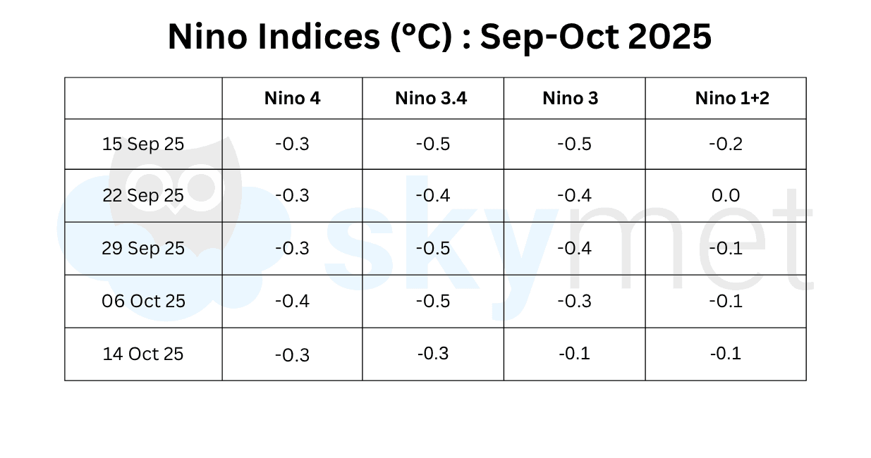
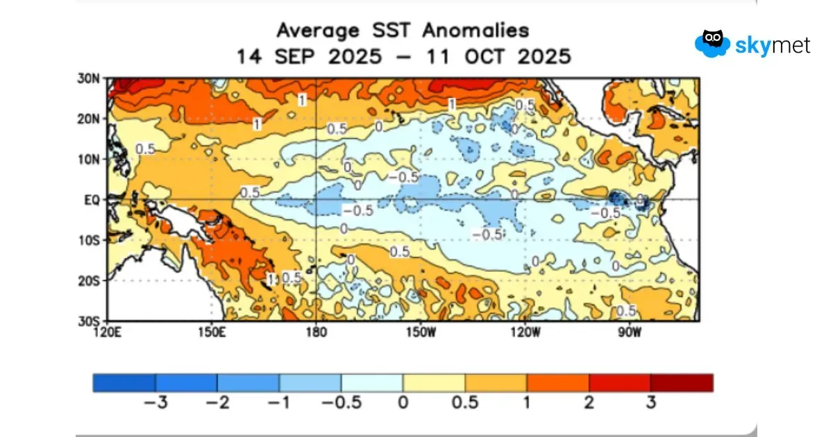
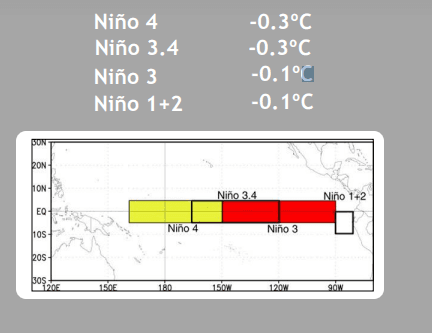
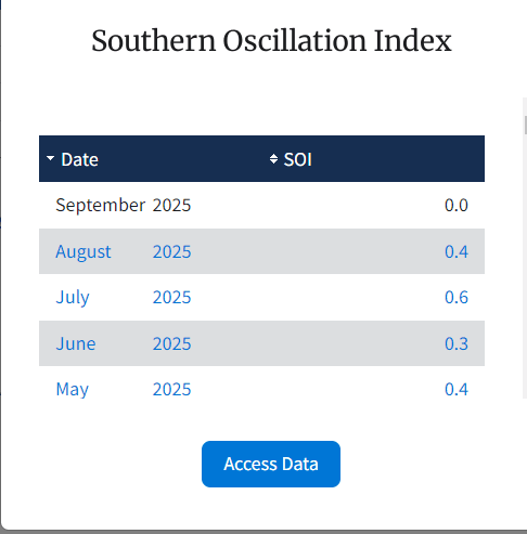
Since mid-August, equatorial SSTs have been near to below average in the central and eastern Pacific Ocean. The central portion of the Niño region between 170°W and 90°W, hosting Niño 3.4 and Niño 3, has been persistently cooling, reaching closer to threshold values since 8th September 2025. However, during the last week, a slight amount of warming has been noticed across the region. Niño 3.4, the marker for ONI, has registered an anomaly of -0.3°C. The Southern Oscillation Index (SOI) continues to be normal in October so far. This indicates volatility along the equatorial Pacific region, and the firm evolution of La Niña may get deferred. The only positive sign is that equatorial SSTs between 14th September and 11th October 2025 remained near to below average across most of the central and eastern Pacific Ocean.
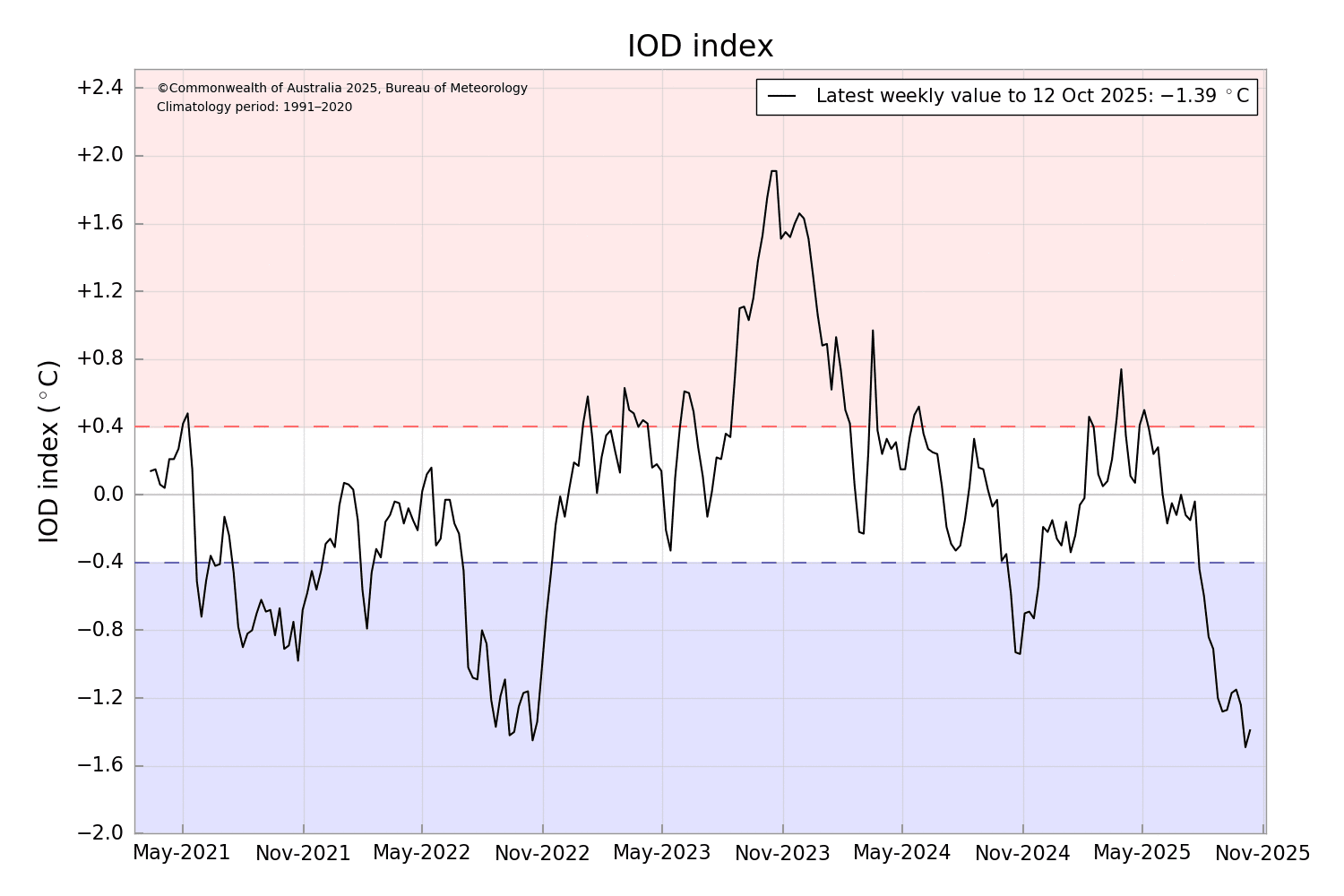
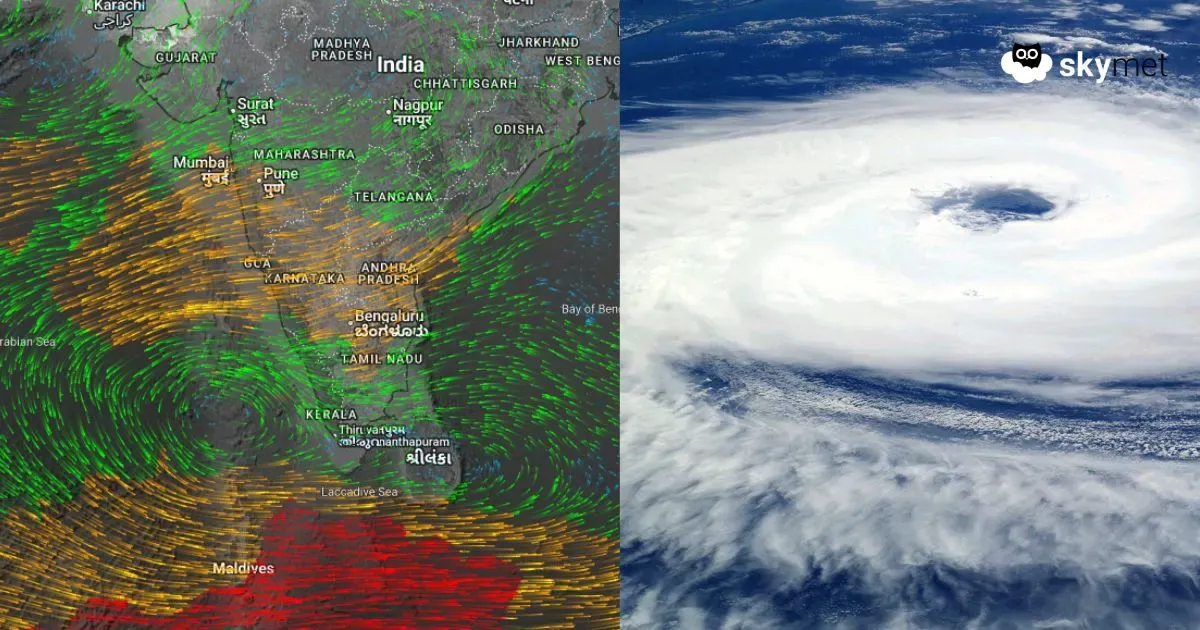
IOD: The negative phase of the Indian Ocean Dipole continues. During this phase, westerly winds intensify along the equator, allowing warmer waters to concentrate near the Australian coast. This sets up a temperature difference across the tropical Indian Ocean, with warmer-than-normal water in the east and cooler-than-normal waters in the western tropical Indian Ocean. A negative IOD is related to deficient Northeast Monsoon (NEM) rainfall. During a negative IOD, there is increased high pressure over the western parts of the equatorial Indian Ocean, which suppresses the moisture-laden winds that bring rains to peninsular India, negatively impacting the Northeast Monsoon. The latest IOD index value for the week ending 12th October 2025 was -1.39°C.
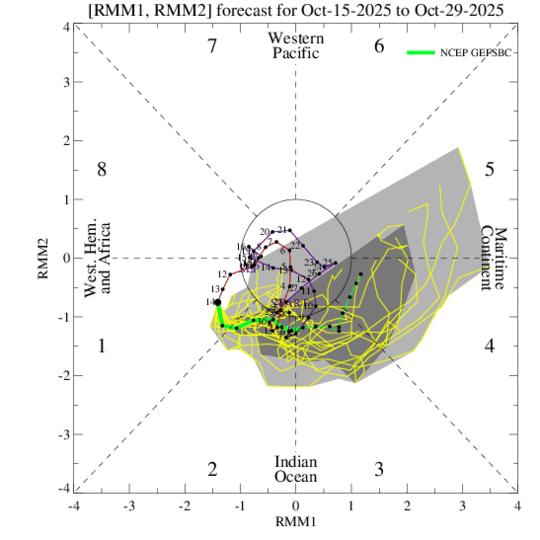
MJO: The Madden–Julian Oscillation is likely to propagate eastward over the Indian Ocean in Phases 1–2–3 for the next two weeks. The MJO signal is expected to strengthen during this period, and the amplitude of the pulse will increase to stay in the outer circle. The MJO phasing will be less supportive of tropical cyclone activity over the Western Pacific. However, as the MJO approaches Phases 2 and 3, the Indian Seas become more favorable for storm development.
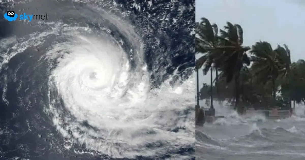
The cyclone season has begun for the Indian Seas. Earlier, tropical cyclone Shakhti formed on 3rd October, west of the Gulf of Kutch. Shakhti drifted slowly westward toward Oman, then turned back eastward, eventually dissipating well away from land in the deep ocean. Another tropical cyclone is likely to form again over the Arabian Sea, but in the equatorial latitudes. This cyclone is unlikely to pose any threat to the Indian coastline. It will head toward the Somalia–Yemen–Oman coast as a severe storm.