Dry And Hot Days For Delhi: Relief Around Weekend

Representational Image: AI-Skymet
Key Takeaways:
- Severe dust storm disrupted flights and damaged parked aircraft in Delhi.
- Temperatures may touch 42°C–43°C between June 8 and June 10.
- Thunderstorm and dust storm activity likely to intensify from June 11 onward.
- Peak pre-monsoon showers expected on June 12 and June 13.
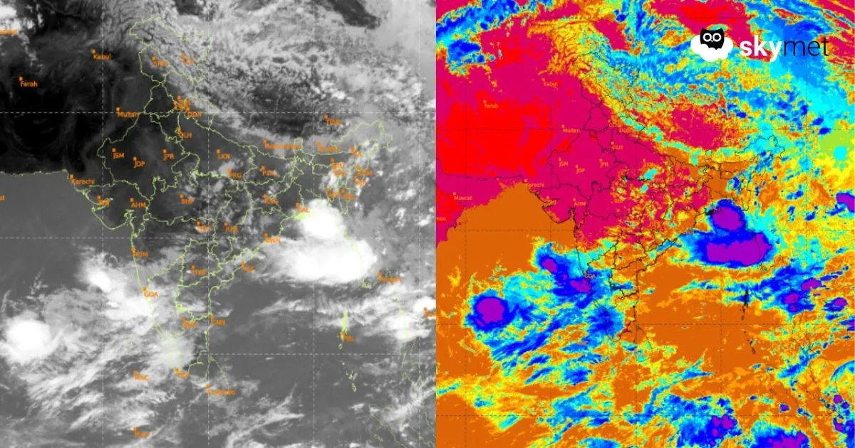
Severe thunderstorm/dust storm hit some parts of Delhi yesterday, in the early evening hours. Hazardous weather conditions resulted diversion of multiple flights, including the international ones, to the neibhouring aerodromes like Jaipur, Chandigarh and Lucknow. ‘Go around’ and ‘holding pattern’ of the flights led to delays in arrival and departure of aroplanes. Very strong winds moved the unsecured ground equipment to damage some parked aircraft in the aprons. Earlier, the day temperature had risen to 41.6°C, the highest so far, in this month. There were some sharp showers in some areas including Palam, where the observatory recorded 3.8mm rainfall. Safdarjung and Lodi Road did not receive any rainfall.
The western disturbance has moved away and the induced circulation over plains also, has become less marked. The east-west trough has shifted north of Delhi, changing the low level wind direction to hot westerlies. Minimal weather activity is expected today and tomorrow, but, the temperature is likely to rise further. Mercury will hover between 42°-43°C, between Monday and Wednesday and gradually drop thereafter. The weekend will witness temperature in mid 30’s. Pre-monsoon showers are likely between Friday and Sunday.
Fresh western disturbance is likely to arrive over the mountains on 11th June. The induced circulation will come up over the plains. The east-west trough will also get activated, keeping proximity with Delhi. Mainly dry and hot conditions will prevail today and tomorrow. There could be a short spell of thunderstorm-dust storm on 10th June. The intensity and spread will increase between 11th and 14th June and the peak activity will be on 12th and 13th June 2026.
Weather activity around the weekend will lower the temperatures, well below the normal. Though, a broad clearance is expected anytime after 14th June, but Delhi/NCR will remain clutched under hot conditions and some freak spell of thunderstorm in some areas can not be ruled out. “Loo” conditions with strong and dry hot winds are likely for the next three days, between 08th and 10th June 2026.