Satellite Image (IST: 12:30 PM) | Courtesy: mosdac.gov.in
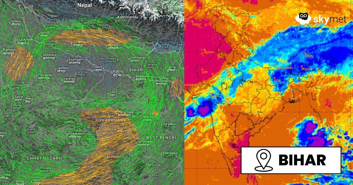
The weakened cyclonic storm Montha, lying over South Chhattisgarh and Vidarbha as a well-marked low-pressure area, has moved north-northwest and is now positioned as a significant low-pressure system over Northeast Madhya Pradesh and North Chhattisgarh. The system is associated with a broad, well-marked cyclonic circulation extending up to higher levels. Though it has weakened considerably, the system still carries the potential to lash the region with heavy rains for another two days.
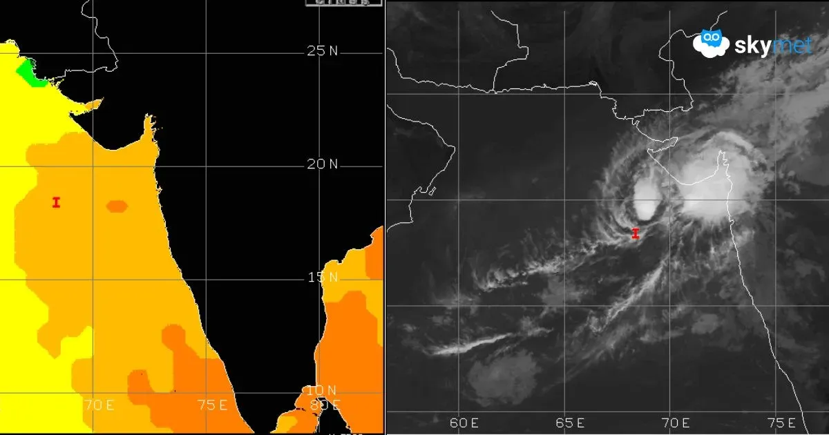
Another weather system, a depression over the Arabian Sea, continues to linger. A northeast–southwest oriented trough axis connects the centers of these two systems. This feature is sustaining weather activity over a larger area than normally expected and prolonging the active lifespan of the weakened storm. The remnant low-pressure area of Cyclone Montha will persist over Bihar, Jharkhand, and North Bengal, remaining more active on 31st October and leaving residual effects on 1st November 2025.
Fairly widespread rain and thundershowers, heavy at a few places, are likely over North Chhattisgarh, Northeast Madhya Pradesh, and adjoining parts of Bihar and East Uttar Pradesh. Areas at moderate risk include Umaria, Satna, Katni, Singrauli, Rewa, Shahdol, Raipur, Durg, Ambikapur, Bemetara, Bijapur, and Dantewada. In Western Bihar and Eastern Uttar Pradesh, affected districts may include Ghazipur, Ballia, Deoria, Mau, Mirzapur, Sonbhadra, Varanasi, Gorakhpur, Patna, Gaya, Saran, Buxar, Gopalganj, Champaran, Nalanda, Rohtas, Bhojpur, and Darbhanga. Later, the rainfall belt will extend into North Bengal, covering Malda, Dinajpur, Murshidabad, Birbhum, and the Sub-Himalayan West Bengal region. Broad clearance over the area is expected from 3rd November onward.
Do not miss: